Berlin in Rensselaer County, New York — The American Northeast (Mid-Atlantic)
Early Toll Road (Berlin, NY)
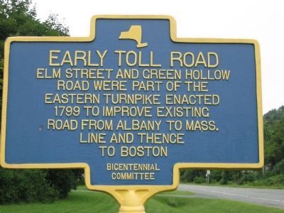
Elm Street and Green Hollow Road were part of the Eastern Turnpike enacted 1799 to improve existing road from Albany to Mass. line and thence to Boston.
Erected by Bicentennial Committee.
Topics. This historical marker is listed in this topic list: Roads & Vehicles. A significant historical year for this entry is 1799.
Location. 42° 41.586′ N, 73° 22.313′ W. Marker is in Berlin, New York, in Rensselaer County. Marker is at the intersection of County Route 38 and New York State Route 22, on the right when traveling east on County Route 38. Touch for map. Marker is in this post office area: Berlin NY 12022, United States of America. Touch for directions.
Other nearby markers. At least 8 other markers are within 7 miles of this marker, measured as the crow flies. Berlin, New York War Memorials (about 500 feet away, measured in a direct line); Van Veachton Rogers (about 500 feet away); The Evangelican Lutheran Church of West Berlin (approx. 3.1 miles away); Came to America (approx. 3.1 miles away); Town of Petersburgh Honor Roll (approx. 4.2 miles away); Reynolds Farm (approx. 6 miles away); Grafton Inn (approx. 6.3 miles away); Town of Grafton War Memorials (approx. 6.6 miles away). Touch for a list and map of all markers in Berlin.
Also see . . . History of Berlin Highways. Town website entry (Submitted on April 16, 2020, by Steve Stoessel of Niskayuna, New York.)
Credits. This page was last revised on February 19, 2023. It was originally submitted on August 15, 2012, by Tom McGreevy of Averill Park, New York. This page has been viewed 499 times since then and 16 times this year. Last updated on September 13, 2015, by Steve Masler of Memphis, Tennessee. Photo 1. submitted on August 15, 2012, by Tom McGreevy of Averill Park, New York. • Bill Pfingsten was the editor who published this page.
Editor’s want-list for this marker. A wide shot of the marker and its surroundings. • Can you help?
