Marker Logo HMdb.org THE HISTORICAL
MARKER DATABASE
“Bite-Size Bits of Local, National, and Global History”
Wrightsville in Johnson County, Georgia — The American South (South Atlantic)
 

Johnson County


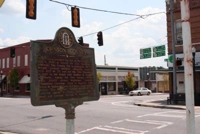
Johnson County Marker image. Click for full size.
Photographed By Mike Stroud, 2009
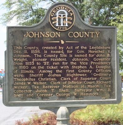
1. Johnson County Marker
Inscription. This County, created by Act of the Legislature Dec. 11, 1858, is named for Gov. Herschel V. Johnson. The County Site is named for John B. Wright, pioneer resident. Johnson, Governor from 1853 to `57, ran for the Vice Presidency in 1860 on the ticket with Stephen A. Douglas of Illinois. Among the first County Officers were: Sheriff Joshua Hightower, Ordinary Theophilus Christian, Clerk of Superior Court James W. Walker, Clerk of Inferior Court Richard Walker, Tax Receiver Madison H. Mason. Tax collector Jacob T. Snell, Surveyor Wm. B. Snell and Coroner George W. Hammock.
 
Erected 1954 by Georgia Historical Commission. (Marker Number 83-1.)
 
Topics and series. This historical marker is listed in this topic list: Settlements & Settlers. In addition, it is included in the Georgia Historical Society series list. A significant historical date for this entry is December 11, 1861.
 
Location. 32° 43.78′ N, 82° 43.168′ W. Marker is in Wrightsville, Georgia, in Johnson County. Marker is at the intersection of North Marcus Street (State Highway 15) and East Elm Street (U.S. 319), on the right when traveling north on North Marcus Street. Courthouse grounds in Wrightsville. Touch for map. Marker is in this post office area: Wrightsville GA 31096, United States of America. Touch for directions.
 
Other nearby markers. At least 8 other markers are within 13 miles of this marker, measured
Paid Advertisement
Click on the ad for more information.
Please report objectionable advertising to the Editor.
Click or scan to see
this page online
as the crow flies. Confederate Memorial (a few steps from this marker); The March to the Sea (a few steps from this marker); Grice Inn (approx. 0.2 miles away); Colby Smith (approx. 8.3 miles away); Claxton Historic Burial Site (approx. 11 miles away); Irwin’s Crossroad (approx. 11.6 miles away); Sherman's Right Wing (approx. 12˝ miles away); Riddleville (approx. 12.7 miles away). Touch for a list and map of all markers in Wrightsville.
 
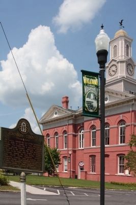
Johnson County Marker and Courthouse image. Click for full size.
Photographed By Mike Stroud, July 12, 2009
2. Johnson County Marker and Courthouse
Johnson County Marker image. Click for full size.
Photographed By Mike Stroud, July 12, 2009
3. Johnson County Marker
At the intersection of N. Marcus St (GA-15.57) and E. Elm St (US 319), SW corner of Courthouse Parking lot
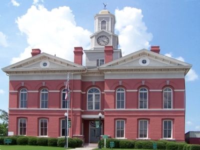
Johnson County Courthouse image. Click for full size.
Photographed By Mike Stroud, 2009
4. Johnson County Courthouse
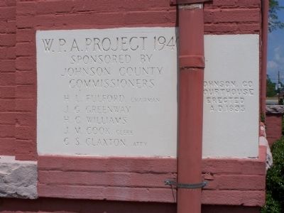
Johnson County Courthouse Cornerstone image. Click for full size.
Photographed By Mike Stroud, 2009
5. Johnson County Courthouse Cornerstone
Johnson Co. Courthouse
Erected A.D. 1895
W.P. A. Project 1940
Sponsored By
Johnson County
Commissioners
( List of names )
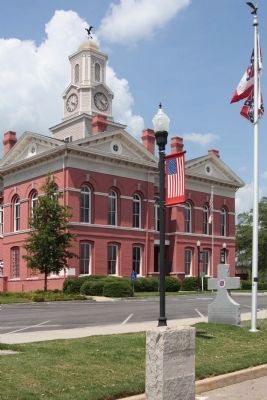
Johnson County Courthouse With Jeff Davis Highway Marker and Confederate Memorial image. Click for full size.
Photographed By Mike Stroud, July 12, 2009
6. Johnson County Courthouse With Jeff Davis Highway Marker and Confederate Memorial
as seen from US 319 - south side of Courthouse
Johnson County Veterans Memorial image. Click for full size.
Photographed By Mike Stroud, July 12, 2009
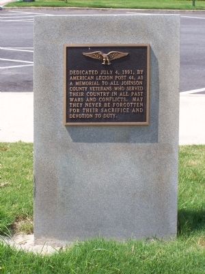
7. Johnson County Veterans Memorial
" Dedicated July 4, 1991, by American Legion Post 44, as a Memorial to all Johnson County Veterans who served their Country in all past wars and conflicts. May they never be forgotten for their sacrifice and devotion to duty. "
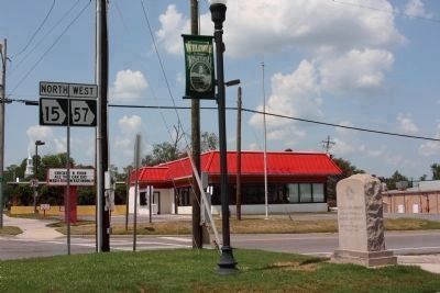
Johnson County Nancy Hart Highway (Ga-15) Thru Wrightsville. Northwest corner of County Courthouse image. Click for full size.
Photographed By Mike Stroud, July 12, 2009
8. Johnson County Nancy Hart Highway (Ga-15) Thru Wrightsville. Northwest corner of County Courthouse
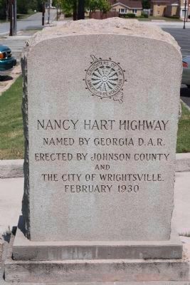
Named by Georgia D.A.R. Erected by Johnson County and The City Of Wrightsville February 1930
Nancy Hart Highway (Ga-15), Thru Wrightsville image. Click for full size.
Photographed By Mike Stroud, July 12, 2009
9. Nancy Hart Highway (Ga-15), Thru Wrightsville
Near Hartwell, Ga.,During the American Revolution, a party of British Tories came to her home. Single handed she killed one and wounded another. The remainder of the party surrendered and were later hanged by her and a few of her neighbors.
 
 
Credits. This page was last revised on June 16, 2016. It was originally submitted on July 18, 2009, by Mike Stroud of Bluffton, South Carolina. This page has been viewed 1,245 times since then and 20 times this year. Last updated on September 13, 2015, by Steve Masler of Memphis, Tennessee. Photos:   1, 2, 3, 4, 5, 6, 7, 8, 9. submitted on July 18, 2009, by Mike Stroud of Bluffton, South Carolina. • Bernard Fisher was the editor who published this page.
Share this page.  
Share on Tumblr
m=88586

CeraNet Cloud Computing sponsors the Historical Marker Database.
This website earns income from purchases you make after using our links to Amazon.com. We appreciate your support.
Paid Advertisement
Apr. 16, 2024