Near Jamestown in Newport County, Rhode Island — The American Northeast (New England)
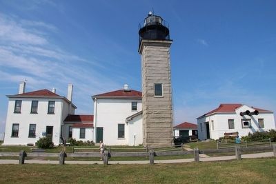
The Keeper's House
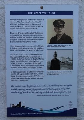
Although most lighthouse keepers were married, at many small lighthouses they lived a solitary life while their families remained on the mainland. Beavertail, being on Conanicut Island, allowed the keepers and their family to live at the site.
There were 27 keepers at Beavertail. The first was Abel Franklin who was appointed in 1749. In 1844, Robert H. Wheeler was appointed keeper. He served four years. After he died, his wife Damaris became Beavertail's first and only female keeper.
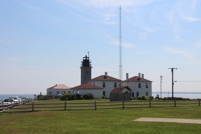
When the current light tower was built in 1856, the U.S. Lighthouse Board constructed this brick lighthouse keeper's residence to replace an older house.
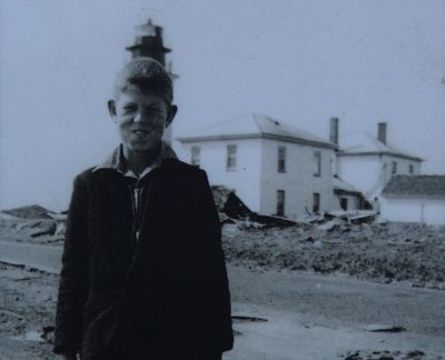
Carl Chellis was the Coast Guard Light Keeper at Beavertail in 1938. When the Great Hurricane of 1938 hit, Chellis' son Clayton, his daughter Marion, and six other children were returning home from school. As the school bus crossed the Mackerel Cove causeway, a huge storm surge hit and only the bus driver and the keeper's son Clayton survived.
In 1939 management of all lighthouses transferred from the U.S. Lighthouse Service to the U.S. Coast Guard. the light was automated in 1972, five years later a property custodian was assigned to provide maintenance and security.
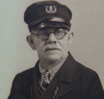
When a sou'easter screeches through here you see some weather. I remember the night a few years ago when a sou'easter came through and raised plenty of trouble. I went out to set the fog signal running and the wind threw me right across the yard, into a wall. I crept over to the whistle house on my hands and knees.
Captain George T. Manders, Lighthouse Keeper, 1913 to 1937
Erected by Beavertail Lighthouse Museum Association.
Topics and series. This historical marker is listed in these topic lists: Disasters • Industry & Commerce • Waterways & Vessels. In addition, it is included in the Lighthouses series list.
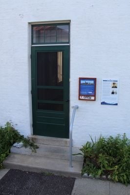
Location. 41° 26.966′ N, 71° 23.959′ W. Marker is near Jamestown, Rhode Island, in Newport County. Marker can be reached from Beavertail Road south of Clarkes Village Road, on the left when traveling south. This marker is located in the Beavertail State Park, affixed to the outside wall, beside the front entrance door of the keeper's house, in the southeast section of the existing lighthouse complex. Touch for map. Marker is in this post office area: Jamestown RI 02835, United States of America. Touch for directions.
Other nearby markers. At least 8 other markers are within walking distance of this marker. Fog Signal Building (here, next to this marker); The Granite Light Tower (a few steps from this marker); Oil Storage Building (a few steps from this marker); The West Passage to Narragansett Bay
(within shouting distance of this marker); The Assistant Keeper's House (within shouting distance of this marker); The 1749 Foundation (within shouting distance of this marker); History of the Beavertail Light Station (within shouting distance of this marker); Whale Rock Lighthouse (within shouting distance of this marker). Touch for a list and map of all markers in Jamestown.
Photographed By Dale K. Benington, July 29, 2015
3. The Keeper's House Marker
Close-up view, that is displayed on the marker, of a photograph showing Keeper Carl Chellis' son Clayton, who was the only survivor from the school bus that was washed off Mackerel Cove causeway in the Great Hurricane of 1938.
Credits. This page was last revised on June 16, 2016. It was originally submitted on September 15, 2015, by Dale K. Benington of Toledo, Ohio. This page has been viewed 464 times since then and 21 times this year. Photos: 1, 2, 3, 4, 5, 6. submitted on September 15, 2015, by Dale K. Benington of Toledo, Ohio.
