Perryville in Boyle County, Kentucky — The American South (East South Central)
Harris' Battery
Perryville • The Battle For Kentucky
— October 8, 1862 —
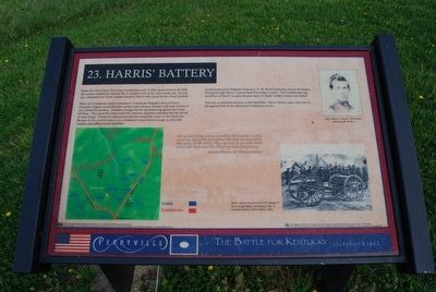
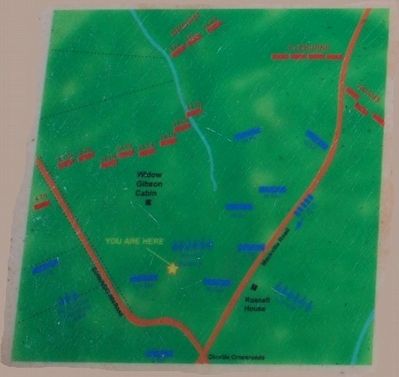
Before the entire Union First Corps (numbering nearly 15,000 men) arrived on the field, this location marked the extreme left, or northern end, of the Union battle line. Six cannon commanded by Union Captain Samuel J. Harris were placed at this crucial position.
When the Confederate attack commenced, Confederate Brigadier General Daniel Donelson's briagade moved from the modern park entrance, located a half-mile in front of you, toward this position. Donelson thought that he was advancing against the Union left flank. Then end of the Union battle line, however, had been extended with the arrival of more troops. Donelson's men instead attacked toward the center of the Union line. Because of this reconnaissance error, Donelson's troops became caught in a horrible crossfire and suffered severe casualties.
Confederates led by Brigadier General S.A.M. Wood eventually overran the battery. During the fight Harris' cannons fired 954 artillery rounds. The Confederates captured four of Harris' six guns because many of Harris' artillery horses were killed.
This was a prominent position on the battlefield. Harris' Battery had a clear line of fire against most of the advancing Confederate troops.
"We moved down across a stubble field under a very accurate shell fire, and about the time we crossed a dry gully in the valley they opened on us with small arms, our boys started dropping more frequently."
Matthews Preston, 33rd Alabama Infantry
(captions)
(upper right) Capt. Samuel J. Harris, 19th Battery, Indiana Light Artillery
(lower right) Harris battery was part of the 34th Brigade. It was a six gun battery consisting of four 12-pounders and two 3-inch ordnance rifles. (Marker Number 23.)
Topics. This historical marker is listed in this topic list: War, US Civil. A significant historical date for this entry is October 8, 1862.
Location. 37° 40.22′ N, 84° 58.727′ W. Marker is in Perryville, Kentucky, in Boyle County. Marker can be reached from Whites Road east of Hays Mays Road, on the right when traveling east. Marker can be reached from the car park along Whites Road. Touch for map. Marker is in this post office area: Perryville KY 40468, United States of America. Touch for directions.
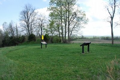
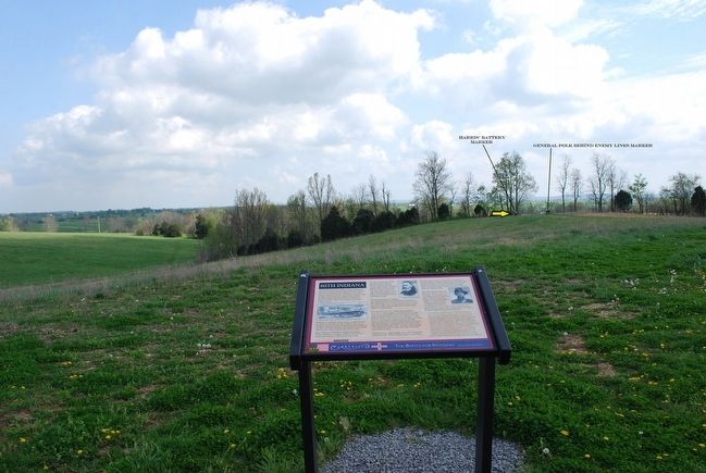
Other nearby markers. At least 8 other markers are within walking distance of this marker. General Polk Behind Enemy Lines (a few steps from this marker); 80th Indiana (within shouting distance of this marker); George P. Webster's Brigade (about 500 feet away, measured in a direct line); The Slaughter Pen (about 700 feet away); Russell House (about 700 feet away); The John C. Russell House (approx. 0.2 miles away); Illinois Soldiers at Perryville (approx. 0.2 miles away); Dixville Crossroads (approx. 0.2 miles away). Touch for a list and map of all markers in Perryville.
Also see . . .
1. Perryville Battlefield State Historic Site. Kentucky State Parks website entry (Submitted on September 16, 2015.)
2. Perryville. Civil War Trust website entry (Submitted on September 16, 2015.)
Credits. This page was last revised on December 15, 2023. It was originally submitted on September 15, 2015, by Brandon Fletcher of Chattanooga, Tennessee. This page has been viewed 541 times since then and 20 times this year. Photos: 1, 2, 3, 4. submitted on September 15, 2015, by Brandon Fletcher of Chattanooga, Tennessee. • Bernard Fisher was the editor who published this page.


