Manassas in Prince William County, Virginia — The American South (Mid-Atlantic)
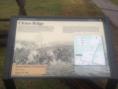
Chinn Ridge
Second Battle of Manassas - Day Three
— August 30, 1862 —
The massive Confederate counterattack appeared unstoppable. General James Longstreet’s wing of the army – upwards of 28,000 troops – steadily pushed east toward Henry Hill. If the Confederates occupied that plateau, ironically the same ground on which the First Battle of Manassas had culminated the previous summer, they could cut off the Federals’ line of retreat and possibly annihilate the Union army.
Finally comprehending the magnitude of the crisis, General John Pope raced to save his command. Pope worked to establish a new defensive position and safeguard his avenue of escape. To gain time for his new line to take shape, the Federal commander ordered additional troops onto Chinn Ridge. Here a handful of Union brigades struggled to slow the Confederate advance and buy that time in blood.
Caption:
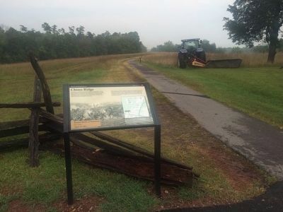
The Chinn Ridge Trail explores the ground on which some of the most sustained combat occurred during the Second Battle of Manassas. An exhibit at the trail’s end addresses the action at First Manassas. The trail is wheelchair accessible.
Topics. This historical marker is listed in this topic list: War, US Civil. A significant historical date for this entry is August 30, 1863.
Location. 38° 48.429′ N, 77° 32.13′ W. Marker is in Manassas, Virginia, in Prince William County. Almost directly across from the entrance to the Henry Hill Visitor Center at Manassas Battlefield Park, there is a one-way access road to the trailhead of the Chinn Ridge Loop. The marker is about 1 mile west on the access road from Sudley Road. This is stop #10 on the current Manassas driving tour. Touch for map. Marker is in this post office area: Manassas VA 20109, United States of America. Touch for directions.
Other nearby markers. At least 8 other markers are within walking distance of this marker. Kemper's Brigade (within shouting distance of this marker); a different marker also named Chinn Ridge (within shouting distance of this marker); 73rd Ohio Infantry (within shouting distance of this marker); Fight at the Fence Line (within shouting distance of this marker); Hazel Plain (about 400 feet away, measured in a direct line); Second Brigade (about 700 feet away); a different marker also named Kemper's Brigade (approx. 0.2 miles away); Defending the Cannon (approx. 0.2 miles away). Touch for a list and map of all markers in Manassas.
More about this marker. This marker replaces a previous marker entitled "Fight at the Fenceline" that was at this same location.
Credits. This page was last revised on June 16, 2016. It was originally submitted on September 16, 2015, by J. Makali Bruton of Accra, Ghana. This page has been viewed 709 times since then and 19 times this year. Photos: 1, 2. submitted on September 16, 2015, by J. Makali Bruton of Accra, Ghana.

