Canton in St. Lawrence County, New York — The American Northeast (Mid-Atlantic)
Logging and Lumbering
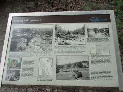
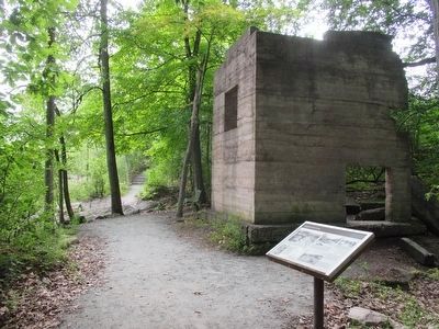
The extensive surface remains of this structure include the stone and concrete walls along the race, the race itself, the foundation of the steam boilers, and the ruin of the sawdust bunker. The square concrete structure is probably the sawdust bunker and was connected to the east side of the mill by an iron blow pipe. When Spears converted from water power to steam, the sawdust and wood scraps were used as fuel for the boilers.
James Spears used a system of tramways on trestles to move lumber to the northern end of Falls Island. Detail of Sanborn map
The spring break-up usually came in April when melting and rains worked together to raise the waters of the Grasse to a high point. The real excitement and danger began when the logs were released into the river and hundreds of thousands of logs moved in one mass. Gangs of lumberjacks traveled with the drive, using peevies and pike poles to keep the logs moving, poling them off the meadows, breaking up jams before they were formed. SLCHA [St. Lawrence County Historical Association]
James Spears converted the water power operation to steam by 1910, which afforded him a more reliable source of power, though the danger of fire was increased. The Spear mill burned in 1912 and was not rebuilt. Canton Town and Village Historian
Fall and winter were devoted to cutting timber and spring was the season to get timber to the mills, Once the trees were felled and cut into 13-foot lengths, the logs were hauled by sled or skidded to the river bank. The owner of a mill was required by law to register a log mark that could be hammered into the end of his logs before they went into the river. St. Lawrence County Clerk's Office
When logs reached the sorting gaps they were either directed to a holding area or allowed to float on downstream to the next mill. Logs were directed down the east channel, close to the island, where they could be lifted by a winch into the saw mill. Some logs may have been directed into the sluiceway that runs through the center of Falls Island. Canton Town and Village Historian
Erected by Grasse River Heritage.
Topics. This historical marker is listed in these topic lists: Industry & Commerce • Waterways & Vessels. A significant day of the year for for this entry is May 31.
Location.
44° 35.807′ N, 75° 10.494′ W. Marker is in Canton, New York, in St. Lawrence County. Marker can be reached from West Main Street (U.S. 11) 0.2 miles east of Gouverneur Street (U.S. 11). Marker is on Heritage Trail on Falls Island in Heritage Park. The park is on the north side of US 11, between the two bridges over the the Grasse River. Touch for map. Marker is in this post office area: Canton NY 13617, United States of America. Touch for directions.
Other nearby markers. At least 8 other markers are within walking distance of this marker. The East Channel of the Grasse River (within shouting distance of this marker); Floods, Fires, and Pollution (within shouting distance of this marker); The Natural Environment (within shouting distance of this marker); The Sash and Blind Factory (within shouting distance of this marker); The Grist Mill (within shouting distance of this marker); The West Channel of the Grasse River (about 300 feet away, measured in a direct line); Water Street and the Third Dam (about 300 feet away); The King Iron Bowstring Bridge (about 400 feet away). Touch for a list and map of all markers in Canton.
Credits. This page was last revised on June 16, 2016. It was originally submitted on September 19, 2015, by Anton Schwarzmueller of Wilson, New York. This page has been viewed 329 times since then and 9 times this year. Photos: 1, 2. submitted on September 19, 2015, by Anton Schwarzmueller of Wilson, New York.

