Marker Logo HMdb.org THE HISTORICAL
MARKER DATABASE
“Bite-Size Bits of Local, National, and Global History”
Near Grenville in Union County, New Mexico — The American Mountains (Southwest)
 

Santa-Fe Trail


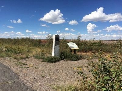
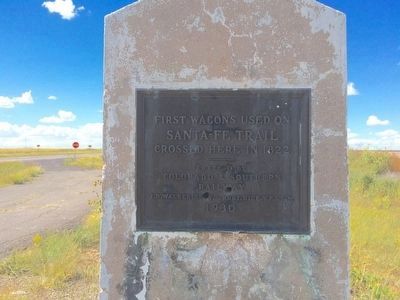
Santa-Fe Trail Marker image. Click for full size.
Photographed By Mark Hilton, September 15, 2015
1. Santa-Fe Trail Marker
Inscription.
First Wagons used on
Santa-Fe Trail
crossed here in 1822
——
Erected by
Colorado & Southern
Railway
J.D. Walker, Supt. - Robt. Rice, V.P. & G.M.
1930

 
Erected 1930 by the Colorado & Southern Railway.
 
Topics and series. This historical marker is listed in these topic lists: Railroads & StreetcarsRoads & Vehicles. In addition, it is included in the Santa Fe Trail series list. A significant historical year for this entry is 1822.
 
Location. 36° 33.992′ N, 103° 34.019′ W. Marker is near Grenville, New Mexico, in Union County. Marker is on U.S. 64, 0.3 miles south of 1st Street (State Road 453), on the left when traveling south. Touch for map. Marker is at or near this postal address: US-64, Grenville NM 88424, United States of America. Touch for directions.
 
Other nearby markers. At least 1 other marker is within walking distance of this marker. The Santa Fe Trail (here, next to this marker).
 
Also see . . .  New Mexico Scenic Drive: Santa Fe Trail. (Submitted on September 19, 2015, by Mark Hilton of Montgomery, Alabama.)
 
Paid Advertisement
Click on the ad for more information.
Please report objectionable advertising to the Editor.
Click or scan to see
this page online
Santa-Fe Trail Marker & nearby interpretive marker near rail lines. image. Click for full size.
Photographed By Mark Hilton, September 15, 2015
2. Santa-Fe Trail Marker & nearby interpretive marker near rail lines.
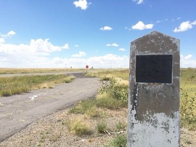
The view north on US Highway 64. image. Click for full size.
Photographed By Mark Hilton, September 15, 2015
3. The view north on US Highway 64.
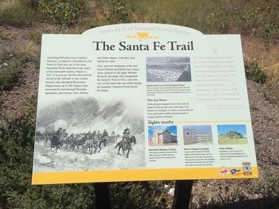
Nearby Santa-Fe Trail Interpretive Marker image. Click for full size.
Photographed By Mark Hilton, September 15, 2015
4. Nearby Santa-Fe Trail Interpretive Marker
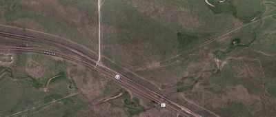
Santa-Fe Trail image. Click for full size.
Photographed By Google Maps
5. Santa-Fe Trail
Southwest & Northeast of the marker on Highway 64, on this map, you can see the straight-line trail still visible today.
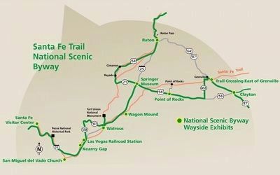
Santa-Fe Trail Map in New Mexico image. Click for full size.
the Federal Highway Administration and the New Mexico Department of Tourism.
6. Santa-Fe Trail Map in New Mexico
Marker is located near the trail shown to the right of map.
 
 
Credits. This page was last revised on June 16, 2016. It was originally submitted on September 19, 2015, by Mark Hilton of Montgomery, Alabama. This page has been viewed 675 times since then and 32 times this year. Photos:   1, 2, 3, 4, 5, 6. submitted on September 19, 2015, by Mark Hilton of Montgomery, Alabama.
Share this page.  
Share on Tumblr
m=88749

CeraNet Cloud Computing sponsors the Historical Marker Database.
This website earns income from purchases you make after using our links to Amazon.com. We appreciate your support.
Paid Advertisement
Apr. 23, 2024