Canton in St. Lawrence County, New York — The American Northeast (Mid-Atlantic)
Water Street and the Third Dam
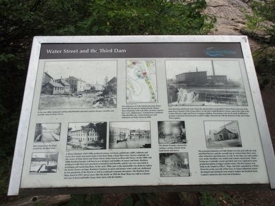
The industries on Falls Island and along Water Street did not operate independently. Rather than competing with each other, in many respects they were collaborators. Detail from a Sanborn Map identifies the various businesses and industries on Water Street in 1898. Detail of Sanborn Map
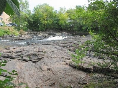
This third dam held back water from the channel that ran parallel to Water Street, just east of the main East Channel of the Grasse River. To the left is Judd Ruston's factory and on the right is the Canton Electric Light and Power Company building. Fluctuating water levels made it difficult to produce consistant electrical power until Canton connected up with the Hannawa Falls and Colton Power plants. SLCHA
Harvesting ice in the pond created by the third dam. Canton Town and Village Historian [both photos]
J. Henry Rushton (1843-1906) produced canoes, rowboats, guideboats, skiffs, sailboats and even a few steam and motor boats in his Boat Shop, a large three-story factory originally on the corner of State Street and Water Street (today known as Riverside Drive). In the 1880s and 1890s Rushton became well known as a designer and builder of canoes and boats. Rushton produced crafts that were practical, economical, and durable, and he was very successful at promoting and marketing them. In the early 1900s, just as the automobile was about to replace the horse-drawn carriage, Rushton's business in sport and leisure water craft was challenged by the popularity of the bicycle as well as a national economic downturn. The Rushton Boat Shop closed in 1917, eleven years after his death. In 1926 the Boat Shop was sold to a farmer who tore it down and built a very large dairy barn with the lumber. SLCHA [both photos]
The Baxter Foundary, known for casting a variety of tools, farm implements and stoves. SLCHA [both photos]
The principal industries on Falls Island were the grist mill, the sash and blind factory, and the sawmill, but at various times there were other industries as well. At one time axes and scythes were made; furniture was crafted and caskets constructed. These businesses eventually ceased operation and were replaced by mass production plants in bigger market areas. The first tannery was built on the island by Elias C. Page, who later expanded to a Water Street lot on the east side of the river. As larger industrial centers developed and chemicals were used to replace the hemlock bark, Canton's tanneries also went out of business. Canton Town and Village Historian
Erected by Grasse River Heritage.
Topics. This historical marker is listed in these topic lists: Industry & Commerce • Waterways & Vessels. A significant historical year for this entry is 1898.
Location. 44° 35.779′ N, 75° 10.443′ W. Marker is in Canton, New York, in St. Lawrence County. Marker can be reached from West Main Street (U.S. 11) 0.2 miles east of Gouverneur Street (U.S. 11). Marker is on Heritage Trail on Falls Island in Heritage Park. The park is on the north side of US 11 between the two bridges over the Grasse River. Touch for map. Marker is in this post office area: Canton NY 13617, United States of America. Touch for directions.
Other nearby markers. At least 8 other markers are within walking distance of this marker. The East Channel of the Grasse River (within shouting distance of this marker); The King Iron Bowstring Bridge (about 300 feet away, measured in a direct line); The West Channel of the Grasse River (about 300 feet away); Logging and Lumbering (about 300 feet away); The Grist Mill (about 300 feet away); Canton's Islands / Falls Island in 1898 (about 300 feet away); The Sash and Blind Factory (about 300 feet away); Rushton Boat Shop (about 400 feet away). Touch for a list and map of all markers in Canton.
Credits. This page was last revised on June 16, 2016. It was originally submitted on September 19, 2015, by Anton Schwarzmueller of Wilson, New York. This page has been viewed 303 times since then and 7 times this year. Photos: 1, 2, 3. submitted on September 19, 2015, by Anton Schwarzmueller of Wilson, New York.


