Near Snyder in Scurry County, Texas — The American South (West South Central)
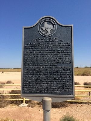
Scurry County's Billionth Barrel of Oil
Petroleum discoveries in this county began in 1923, with recovery of oil in the San Andres Formation—eventually penetrated by over 2,000 shallow wells.
In late 1948, rigs drilling deeper than 6,000 feet tapped the Canyon Reef Geological Formation. Four exploratory wells—Sun Oil Company's Schattel; Magnolia's Winston; Standard Oil Company of Texas Brown; Lion Oil Company's C. T. McLaughlin—and other extensive drilling defined a gigantic field covering 85,000 acres and containing oil reserves estimated to total at least four billion barrels.
The local economy and growth rate improved greatly. Many farmers and ranchers who had fought years of drouth and adversity paid off debts, modernized their homes, and continued to live on their land.
On Oct. 8, 1973, twenty-five years after the Canyon Reef discovery, Scurry County produced from that formation its billionth barrel of oil, and in a week of festivities paid tribute to the petroleum industry. The celebrated billionth barrel of oil came from the well near this marker. By 1973, Scurry County was producing 3.2 per cent of all the oil recovered annually in the United States.
Erected 1975 by Texas Historical Commission. (Marker Number 4621.)
Topics. This historical marker is listed in these topic lists: Exploration • Industry & Commerce. A significant historical year for this entry is 1923.
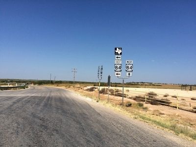
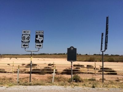
Location. 32° 47.621′ N, 100° 57.548′ W. Marker is near Snyder, Texas, in Scurry County. Marker is at the intersection of Farm to Market Road 1611 and U.S. 84, on the right when traveling south on Road 1611. Touch for map. Marker is in this post office area: Snyder TX 79549, United States of America. Touch for directions.
Other nearby markers. At least 8 other markers are within 6 miles of this marker, measured as the crow flies. Home County of Famous Frontiersmen J. Wright Mooar (approx. 3.7 miles away); Von Roeder Cotton Breeding Farms (approx. 4.6 miles away); The Block 97 Controversy (approx. 5 miles away); Snyder Cemetery (approx. 5.4 miles away); T. J. Faught (approx. 5.4 miles away); Scurry County Veterans Memorial (approx. 5½ miles away); Dermott (approx. 5.6 miles away); Witness Tree (approx. 5.6 miles away). Touch for a list and map of all markers in Snyder.
Credits. This page was last revised on June 16, 2016. It was originally submitted on September 21, 2015, by Mark Hilton of Montgomery, Alabama. This page has been viewed 1,260 times since then and 135 times this year. Photos: 1, 2, 3. submitted on September 21, 2015, by Mark Hilton of Montgomery, Alabama.


