Marker Logo HMdb.org THE HISTORICAL
MARKER DATABASE
“Bite-Size Bits of Local, National, and Global History”
Corinth in Alcorn County, Mississippi — The American South (East South Central)
 

William P. Rogers

Battery Robinett


William P. Rogers Marker image. Click for full size.
Photographed By Brandon Fletcher, November 30, 2008
1. William P. Rogers Marker
Inscription.
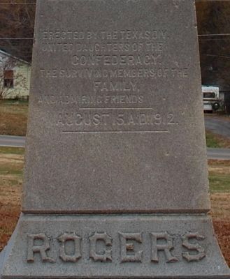
(front)
Rogers

Erected by the Texas Div.
United Daughters of the
Confederacy
the surviving members of the
family,
and admiring friends

August 15, A.D. 1912.
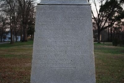
(back)
William P. Rogers
A native of Alabama
December 17, A.D. 1817
Captain of Mississippi Rifles
1845-47.
First man to mount walls
at Monterey
U.S. Consul to Mexico 1849
Signed Ordinance of Secession
of Texas Feb. 1861
Col. 2nd Tex. Infantry
Brevet Brigade Commander.

 
Erected 1912 by Texas Division, United Daughters of the Confederacy.
 
Topics. This memorial is listed in these topic lists: War, Mexican-AmericanWar, US Civil.
 
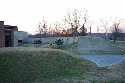
Location. 34° 56.258′ N, 88° 31.735′ W. Marker is in Corinth, Mississippi, in Alcorn County. Memorial is at the intersection of West Linden Street and Sharp Street, on the left when traveling west on West Linden Street. Located on the grounds of Battery Robinett at the Corinth Civil War Interpretive Center. Touch for map. Marker is at or near this postal address: 501 W Linden St, Corinth MS 38834, United States of America. Touch for directions.
 
Other nearby markers. At least 8 other markers are within walking distance of this marker. Brigadier-General Joseph Lewis Hogg (a few steps from this marker);
Paid Advertisement
Click on the ad for more information.
Please report objectionable advertising to the Editor.
Click or scan to see
this page online
Texas Memorial (within shouting distance of this marker); Battle of Corinth - 1862 (approx. ¼ mile away); Weaver Pants Factory (approx. 0.4 miles away); Corinth Panorama — 1862 (approx. 0.4 miles away); Union Troops at Corinth (approx. 0.4 miles away); The Duncan House (approx. 0.4 miles away); a different marker also named The Duncan House (approx. 0.4 miles away). Touch for a list and map of all markers in Corinth.
 
Also see . . .  Shiloh National Military Park - Corinth. National Park Service (Submitted on September 26, 2015.) 
 
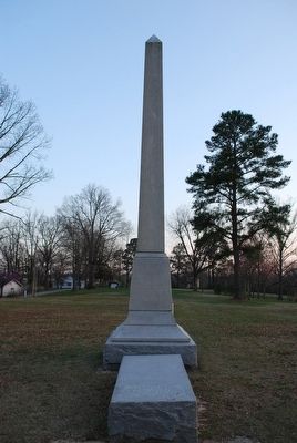
William P. Rogers Marker image. Click for full size.
Photographed By Brandon Fletcher, November 30, 2008
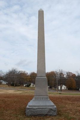
2. William P. Rogers Marker
Front
William P. Rogers Marker image. Click for full size.
Photographed By Brandon Fletcher, March 18, 2011
3. William P. Rogers Marker
Back
William P. Rogers Marker image. Click for full size.
Photographed By Brandon Fletcher, March 18, 2011
4. William P. Rogers Marker
William P. Rogers Marker image. Click for full size.
Photographed By Brandon Fletcher, March 18, 2011
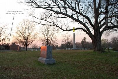
5. William P. Rogers Marker
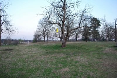
Marker's location (yellow arrow) in relation to the Corinth Civil War Interpretive Center.
William P. Rogers Marker image. Click for full size.
Photographed By Brandon Fletcher, March 18, 2011
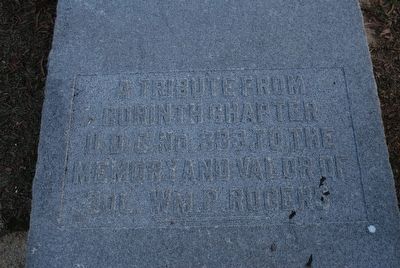
6. William P. Rogers Marker
William P. Rogers Marker image. Click for full size.
Photographed By Brandon Fletcher, March 18, 2011
7. William P. Rogers Marker
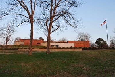
Markers location at Battery Robinett (yellow arrow)
Corinth Civil War Interpretive Center image. Click for full size.
Photographed By Brandon Fletcher, March 18, 2011
8. Corinth Civil War Interpretive Center
Corinth Civil War Interpretive Center image. Click for full size.
Photographed By Brandon Fletcher, March 18, 2011
9. Corinth Civil War Interpretive Center
Corinth Civil War Interpretive Center image. Click for full size.
Photographed By Brandon Fletcher, March 18, 2011
10. Corinth Civil War Interpretive Center
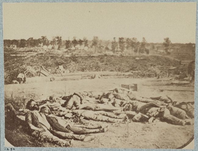
Confederate dead in front of Fort Robinette, Corinth, Mississippi image. Click for full size.
Photographed By Brandon Fletcher
11. Confederate dead in front of Fort Robinette, Corinth, Mississippi
Courtesy Library of Congress
 
 
Credits. This page was last revised on June 16, 2016. It was originally submitted on September 25, 2015, by Brandon Fletcher of Chattanooga, Tennessee. This page has been viewed 567 times since then and 33 times this year. Photos:   1, 2, 3, 4, 5, 6, 7, 8, 9, 10, 11. submitted on September 25, 2015, by Brandon Fletcher of Chattanooga, Tennessee. • Bernard Fisher was the editor who published this page.
Share this page.  
Share on Tumblr
m=89042

CeraNet Cloud Computing sponsors the Historical Marker Database.
This website earns income from purchases you make after using our links to Amazon.com. We appreciate your support.
Paid Advertisement
Apr. 23, 2024