Mt. Shasta in Siskiyou County, California — The American West (Pacific Coastal)
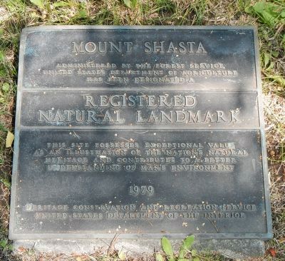
Mount Shasta
Registered Natural Landmark
This site possesses exceptional value as an illustration of the nation's natural heritage and contributes to a better understanding of man's environment.
1979
Heritage, conservation and recreation service
United States Department of the Interior
Erected 1979 by United States Department of the Interior.
Topics and series. This historical marker is listed in this topic list: Natural Features. In addition, it is included in the National Natural Landmarks series list.
Location. 41° 18.868′ N, 122° 18.958′ W. Marker is in Mt. Shasta, California, in Siskiyou County. Marker can be reached from West Alma Street near Maple Street when traveling south. Touch for map. Marker is at or near this postal address: 235 West Alma Street, Mount Shasta CA 96067, United States of America. Touch for directions.
Other nearby markers. At least 8 other markers are within 7 miles of this marker, measured as the crow flies. Mt. Shasta Herald (approx. 0.2 miles away); Berryvale Post Office (approx. 0.7 miles away); Strawberry Valley Stage Station (approx. 0.7 miles away); Sullaway Stage Stop (approx. 1˝ miles away); The Alexander Dunsmuir Fountain (approx. 6˝ miles away); Babe Ruth Played Here (approx. 6˝ miles away); Locomotive 1727 (approx. 6.6 miles away); Upper Soda Springs (approx. 6.8 miles away).
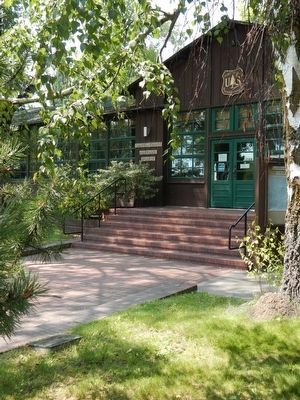
More about this marker. This marker in front of the entrance to the Shasta-Trinity National Forest office.
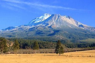
Also see . . . Mount Shasta - Wikipedia. Mount Shasta is a potentially active volcano located at the southern end of the Cascade Range in Siskiyou County, California. At 14,179 feet it is the second highest peak in the Cascades and the fifth highest in California.... The California Gold Rush brought the first Euro-American settlements into the area in the early 1850s, including at Yreka, California and Upper Soda Springs. The first recorded ascent of Mount Shasta occurred in 1854 (by Elias Pearce), after several earlier failed attempts. In 1856, the first women (Harriette Eddy, Mary Campbell McCloud, and their party) reached the summit. (Submitted on September 27, 2015, by Barry Swackhamer of Brentwood, California.)
Credits. This page was last revised on June 16, 2016. It was originally submitted on September 27, 2015, by Barry Swackhamer of Brentwood, California. This page has been viewed 409 times since then and 12 times this year. Photos: 1, 2, 3. submitted on September 27, 2015, by Barry Swackhamer of Brentwood, California.


