Bayeux in Calvados, Normandy, France — Western Europe
Le palais Episcopal
Bishop’s Palace
— Bayeux, la Qualité a ses Racines —
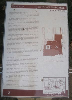
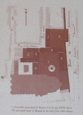
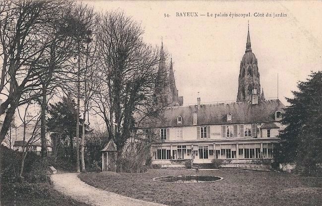
L’ancienne résidence des évêques de Bayeux est un ensemble architectural complexe. Il se développe, depuis le Moyen Age, sur le flanc nord de la cathédrale autour d’une cour (1), d’un ancien cloître (2), et d’un jardin d’agrément (3).
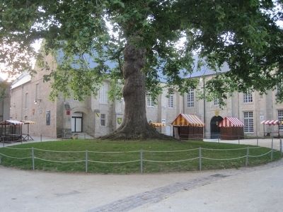
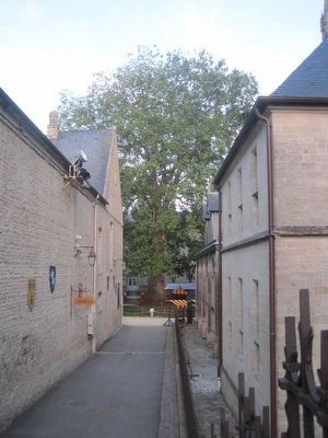
La place de la Liberté (1) est l’ancienne cour intérieure de l’ensemble épiscopal. Depuis 1793, les bâtiments saisis comme biens nationaux sont dévolus à l’administration civile. Au cœur du nouveau lieu de pouvoir est planté en 1797 un platane, arbre de la Liberté qui donne son nom à la place actuelle.
Jusqu’à la fin du XIXe siècle, une galerie (4) reliait le palais a la cathédrale a l’emplacement de l’actuelle sacristie. Dans son prolongement, se développe la partie la plus ancienne du palais actuellement conservée (5), possédant une façade du XVe siècle. Au rez-de-chaussée, on y trouvait l’officialité, c’est-à-dire le tribunal de l’évêque. L’étage abritait quant à lui les appartements du prélat.
L’aile en retour (6), qui date de la fin du XVe et du début du XVIe siècle, constituait l’espace d’apparat dans lequel l’évêque recevait ses hôtes de marque. On y trouve à l’étage la grande salle des audiences avec, dans son prolongement, la chapelle épiscopale particulièrement remarquable par son décor intérieur des XVIe et XVIIe siècles.
La partie la plus majestueuse de l’édifice, qui abrite aujourd’hui l’hôtel de ville (7), est édifiée entre 1768 et 1771. Le porche d’entrée, à l’angle des rues Laitière et de la Chaine, fait également partie de ce programme d’agrandissement.
La cour intérieure est clôturée du côté des anciens remparts par un édifice du milieu du XIXe siècle (8), remplaçant un bâtiment d’époque médiévale. Sa sévérité est en rapport avec sa fonction jusqu’au milieu du XXe siècle : la maison d’arrêt de la ville.
Since the Middle Ages, the former residence of the Bishops of Bayeux has extended along the north flank of the Cathedral around a courtyard (1), a former cloister (2), and a pleasure garden (3).
The Place de la Liberte (1) used to be its inner courtyard. Since the Revolution, the buildings have been used as administrative offices and in 1797 a Liberty tree (a plane tree) was planted in the centre of the square.
On the site of the present vestry an arcade (4) used to link the palace with the Cathedral. This extends into the oldest (15th century), currently restored part
of the palace (5) with the Episcopal Court on the ground floor and the Prelate's apartments on the first floor.
The angled wing (6) (late 15th - 16th century) formed the Bishop's public apartments with, on the first floor, the large throne room, extending into the Episcopal chapel.
The most majestic part, now housing the Hôtel de Ville (City Hall) (7) was built between 1768 and 1771.
Finally, the east wing (8), the former city gaol, is a building dating from the middle of the 19th century, erected on the site of a medieval building.
Erected by La ville de Bayeux. (Marker Number 2.)
Topics and series. This historical marker is listed in these topic lists: Churches & Religion • Settlements & Settlers. In addition, it is included in the France - Bayeux - Circuit du Vieux Bayeux series list.
Location. 49° 16.546′ N, 0° 42.185′ W. Marker is in Bayeux, Normandie (Normandy), in Calvados. Marker is at the intersection of Place de la Liberté and Passage Flachat on Place de la Liberté. Touch for map. Marker is in this post office area: Bayeux, Normandie 14400, France. Touch for directions.
Other nearby markers. At least 8 other markers are within walking distance of this marker. L'Esplanade Flachat (within shouting distance of this marker); Les Abords du Chevet de la Cathédrale (within shouting distance of this marker);
Un édifice du Xe siècle (within shouting distance of this marker); Le Doyen du Chapitre (within shouting distance of this marker); Le Rempart Gallo-Roman (within shouting distance of this marker); 50th Northumbrian Division Memorial (about 90 meters away, measured in a direct line); Autour des Augustines (about 180 meters away); Le Quartier du Pont Saint-Jean (about 180 meters away). Touch for a list and map of all markers in Bayeux.
Credits. This page was last revised on September 10, 2018. It was originally submitted on September 28, 2015, by Kevin W. of Stafford, Virginia. This page has been viewed 315 times since then and 2 times this year. Photos: 1, 2, 3, 4, 5. submitted on September 28, 2015, by Kevin W. of Stafford, Virginia. 6. submitted on September 29, 2015. • Andrew Ruppenstein was the editor who published this page.
