East Columbia in Brazoria County, Texas — The American South (West South Central)
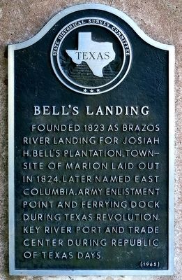
Bell's Landing
Erected 1965 by State Historical Survey Committee. (Marker Number 9528.)
Topics. This historical marker is listed in these topic lists: Industry & Commerce • Settlements & Settlers. A significant historical year for this entry is 1823.
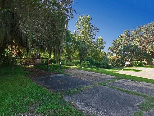
Location. 29° 8.453′ N, 95° 36.919′ W. Marker is in East Columbia, Texas, in Brazoria County. Marker is at the intersection of Austin Street (County Route 300E) and Front Street (County Route 300B) when traveling south on Austin Street. You will dead end at the marker when going south on Austin Street. Touch for map. Marker is in this post office area: West Columbia TX 77486, United States of America. Touch for directions.
Other nearby markers. At least 8 other markers are within walking distance of this marker. Site of Carry Nation's Hotel (within shouting distance of this marker); East Columbia Historic District (about 300 feet away, measured in a direct line); The Ammon Underwood House (about 600 feet away); Sweeny-Waddy Log Cabin (about 600 feet away); "Columbia Blues" (approx. 0.2 miles away); Dance Gun Shop (approx. 0.2 miles away); Aldridge - Smith House (approx. 0.2 miles away); Tyler-Bryan-Weems House (approx. 0.2 miles away). Touch for a list and map of all markers in East Columbia.
More about this marker. CAUTION: DO NOT try to go to the coordinates given on the State of Texas Historical Commission website. They will take you down a dead end on the wrong side of the river where some hostile people live.
Also see . . .
1. Article on East Columbia from The Texas Handbook. (Submitted on October 4, 2015, by Jim Evans of Houston, Texas.)
2. Article on the Brazon River from The Texas Handbook. (Submitted on October 4, 2015, by Jim Evans of Houston, Texas.)
3. Article on the Brazon River in Wikipedia. (Submitted on October 4, 2015, by Jim Evans of Houston, Texas.)
Credits. This page was last revised on June 16, 2016. It was originally submitted on October 4, 2015, by Jim Evans of Houston, Texas. This page has been viewed 983 times since then and 85 times this year. Photos: 1, 2. submitted on October 4, 2015, by Jim Evans of Houston, Texas. • Bernard Fisher was the editor who published this page.

