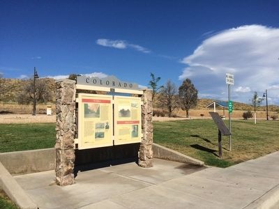
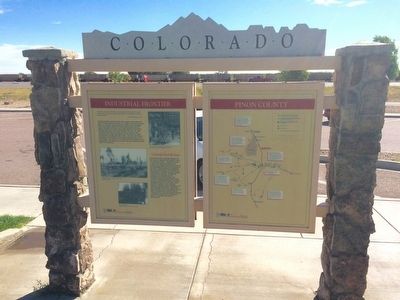
Near Pueblo in Pueblo County, Colorado — The American Mountains (Southwest)
Pueblo - Trail Days / Industrial Frontier - Pinon County
Panel 1
El Pueblo
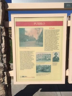
El Pueblo never achieved great commercial success, but one could make a living there. Built in 1842 by traders George Simpson, Matthew Kinkead, Robert Fisher, Jim Beckwourth, and several others, El Pueblo stood at a long-established crossroads with well-traveled roads and rich bottomland. Located on the north bank of the Arkansas River -- the international boundary between Mexico and the United States -- the adobe fort was a cooperative venture which proffered guns, powder, beads, and trade cloth to customers on both sides of the border. With a peak population of about 150 men, women, and children, El Pueblo had the feel of a semi-permanent settlement. But its uneven reputation scared some customers away, and the proprietors, having hoped for better profits, all departed by 1848. After a deadly Ute attack in 1854, El Pueblo was abandoned for good.
The town of Pueblo emerged as a center of industry soon after its 1860 founding, developing one of the deepest industrial bases and richest ethnic fabrics in Colorado. Waves of Europeans came to work in the city's steel mills, smelters, and factories -- Germans, Irish, Italians, Hungarians, Poles, Czechs, Slovenians, Greeks, and Japanese among others. By 1900 more than half of Pueblo's residents were immigrants or first-generation Americans. Widely known as "the Pittsburgh of the West," it had much in common with northeastern factory towns, including periodic labor strife and bustling ethnic neighborhoods such as Goat Hill, St. Charles Mesa, and Peppersauce Bottoms. A 1921 flood left central Pueblo underwater, but the sturdy community rebuilt. Pueblo remains one of Colorado's great cities.
Large photo at top:
(Caption) Downtown Pueblo, circa 1900
Courtesy Denver Public Library, Western History Department
Middle photo
(Caption) Japanese-American baseball team, 1928.
Courtesy Pueblo Library, Hassey Collection
Small photo on right
(Caption) Famed African-American mountain man Jim Beckwourth resided at El Pueblo during the winter of 1842-43.
Colorado Historical Society
Bottom photo
(Caption) Smelter Hill was home to a succession of immigrant groups, including Italians and Mexicans. Adobe homes and conspicuous hornos (beehive shaped earthen ovens) signal Hispanic settlement, circa 1890.
Courtesy Denver Public Library, Western History Department
Panel 2
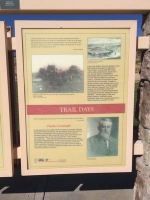
"A good sized steer when it is fit for the butcher market will bring from $45.00 to $60.00. The same animal at its birth was worth but $5.00. He has run on the plains and cropped the grass from the public domain for four or five years, and now, with scarcely any expense to its owner, is worth forty dollars more than when he started....and that is why our cattlemen grow rich." Breeder's Gazette
It was that simple: drive the $5 steer to the $50 market and pocket the difference. Easy money. In post-Civil War Texas, where cattle outnumbered people six to one, almost anyone could cobble together a presentable herd and prod it north. From the late 1860s through the end of the century, hundreds of thousands of Texas steers hit the trail annually. Roughly a quarter of them came through here, on the Goodnight-Loving Trail. Though rougher, drier, and more exposed than routes into Kansas, the Goodnight-Loving Trail provided access to unclaimed grasslands and growing consumer markets as well as railheads. Thanks largely to this hoof-beaten highway, Colorado's cattle population grew from a scattered handful in 1860 to more than a million by 1880.
Charles Goodnight
"Charles Goodnight approaches greatness more nearly than any other cowman of history." J. Frank Dobie, Cow People
In pioneering the first cattle trail from Texas to Colorado, Charles Goodnight risked everything. He and partner Oliver Loving drove 2,000 longhorns over nearly one thousand miles of trackless prairie in 1866, enduring Indian raids, dust storms, and four waterless days in the Texas panhandle. Their reward: a $12,000 sale and the eternal gratitude of the nation's stockmen. Goodnight settled just west of here at Rock Canon Ranch, bringing 30,000 head into Colorado. An economic downturn in the late 1870s ruined him financially, and he returned to Texas to build a new cattle empire. But this inspirational figure left a rich legacy in Colorado's economy and lore.
Drawing of cattle drive
(Caption) A trail herd of Texas Longhorns
Colorado Historical Society
Large photo
(Caption) A fixture of Western cattle drives, the chuck wagon is said to have been invented by Charles Goodnight.
Courtesy C. Bowen, Lamar, Colorado
Portrait of Goodnight
(Caption) Charles Goodnight
Colorado Historical Society
Panel 3
"The natural resources of the State are so great and varied that capital irresistibly turned to the business of converting the raw materials so abundantly provided into finished products."
from Colorado Manufactures, 1904
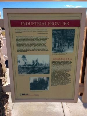
Though it clashes with the myth of the rugged individualist, the truth is that the Colorado frontier was largely urban and industrial. Mills, ore refineries, packing houses, canneries, and assembly plants rose within a decade of the first gold strikes, and the region's bountiful resources and hungry markets powered the development of ever more sophisticated industries. By 1900 Colorado production lines were churning out metals, farm machinery, beer, sugar, and cigars, and the state's per capita manufacturing rate equaled that of Ohio. Over the next century aerospace and computer firms brought high technology to the Front Range. The romance of Colorado will always belong to the prospectors and cowboys, but most of the heavy lifting has taken place in the factories.
Colorado Fuel & Iron
Among Colorado's corporate citizens, few have been as important as Colorado Fuel and Iron. Created by merger in 1879, this industrial colossus soon ranked as the largest steel producer west of the Mississippi and one of the 10 largest in the world. CF&I's billowing smokestacks often darkened the skies over Pueblo, but those plumes of exhaust brought sunshine to the region's economy. By 1904 the company, now bankrolled by the Rockefeller and Gould families, was Colorado's largest employer (with 17,000 workers) and heaviest taxpayer. As a fully integrated steel and fuel producer CF&I controlled quarries, mines, smelters, railroads, workshops, land companies, and banks throughout the West. Along with these interests, CF&I's prodigious output of steel — everything from wire and rails to rivets and nails — and vast financial reserves constituted a framework for Colorado's growth, the girders and beams of development.
Top right photo
(Caption) Beet sugar factory, southeastern Colorado, 1902
Courtesy Denver Public Library, Western History Department
Middle photo
(Caption) Colorado Fuel & Iron, Minnequa Steel Plant
Colorado Historical Society
Bottom photo
(Caption) Wire mill at CF&I
Courtesy Denver Public Library, Western History Department
Panel 4
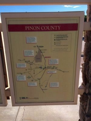
'Regional Map'
Erected 1998 by the Colorado Historical Society, Colorado Department of Transportation. (Marker Number 219.)
Topics and series. This historical marker is listed in these topic lists: Animals • Industry & Commerce • Natural Resources • Settlements & Settlers. In addition, it is included in the Colorado - History Colorado series list. A significant historical year for this entry is 1842.
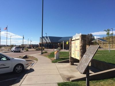
Location. 38° 27.148′ N, 104° 36.429′ W. Marker is near Pueblo, Colorado, in Pueblo County. Marker can be reached from Interstate 25 at milepost 111.6,, 2˝ miles south of Young Hollow Road when traveling south. Located at the CDOT Pueblo South Rest Area. Touch for map. Marker is in this post office area: Pueblo CO 81008, United States of America. Touch for directions.
Other nearby markers. At least 8 other markers are within 14 miles of this marker, measured as the crow flies. A Highway for the Ages - Trail Days / Palmer's City - Pinon County (approx. 3.4 miles away); Pueblo West Veterans Memorial (approx. 11.4 miles away); Temple Emanuel (approx. 12 miles away); Fort Pueblo (approx. 12.8 miles away); Teresita Sandoval (approx. 12.8 miles away); Borderland - Pueblo / Railroads - Pueblo Country (approx. 12.9 miles away); Jacob Fowler's Lookout - Fountain City (approx. 13.1 miles away); The Mormon Battalion (approx. 13.6 miles away). Touch for a list and map of all markers in Pueblo.
Also see . . .
1. History of Pueblo. (Submitted on October 4, 2015, by Mark Hilton of Montgomery, Alabama.)
2. El Pueblo History Museum. Organization website. (Submitted on October 1, 2020, by Larry Gertner of New York, New York.)
Credits. This page was last revised on October 1, 2020. It was originally submitted on October 4, 2015, by Mark Hilton of Montgomery, Alabama. This page has been viewed 702 times since then and 18 times this year. Photos: 1, 2, 3, 4, 5, 6, 7. submitted on October 4, 2015, by Mark Hilton of Montgomery, Alabama.
