Las Cruces in Doña Ana County, New Mexico — The American Mountains (Southwest)
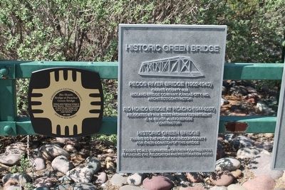
The Historic Green Bridge
Topics. This historical marker is listed in this topic list: Bridges & Viaducts.
Location. 32° 17.941′ N, 106° 43.211′ W. Marker is in Las Cruces, New Mexico, in Doña Ana County. Marker is located on the grounds of the Farm and Ranch Heritage Museum, in Las Cruces, NM. Touch for map. Marker is at or near this postal address: 4100 Dripping Springs Road, Las Cruces NM 88011, United States of America. Touch for directions.
Other nearby markers. At least 8 other markers are within 4 miles of this marker, measured as the crow flies. María Gutiérrez Spencer (approx. 2.4 miles away); Miller Field Gates (approx. 2.4 miles away); America's First Battle of World War II: The Philippines (approx. 3 miles away); Heroes of Bataan (approx. 3 miles away); Doña Ana County Courthouse (approx. 3½ miles away); Rio Grande Theatre (approx. 3½ miles away); The Branigan Building (approx. 3.6 miles away); The Santa Fe Railroad Depot (approx. 4 miles away). Touch for a list and map of all markers in Las Cruces.
Photographed By Wyndfire, August 1, 2015
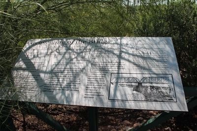
2. Architecture of the Bridge Marker
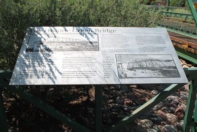
Iron and steel truss bridges gained popularity after the American Civil War during the expansion of railroads across the country. With bigger and heavier trains, these structures were much sturdier than their timber-frame predecessors.
When Chaves County decided to build a sturdy, dependable bridge across the Pecos River in 1902, they benefited from several decades of advances in bridge building techniques, materials, and scientific approaches. By then a number of Midwestern companies had emerged to fill a growing need for railroad and highway bridges. Rather than build something on their own, Chaves County looked to these companies for advice.
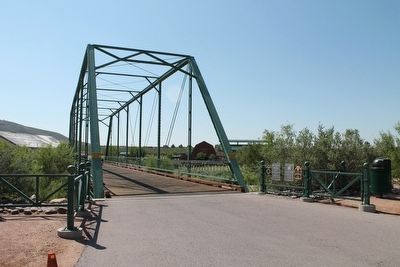
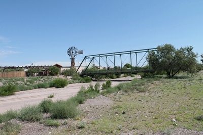
The design recommended and built by the Midland Bridge Company of Kansas City was one of several standard types of the day - a Pratt Through-Truss (patented by Thomas and Caleb Pratt in 1844). In this type, all the diagonal structures (except for the end ones) slant downward toward the middle of the bridge. These trusses support the weight of the bridge and traffic. Through-truss means the deck is at the bottom of the truss system, so traffic passes "through" the trusses when crossing.
(Text is repeated in Spanish on the second half of the plaque.)
Photographed By Wyndfire, August 1, 2015
3. The Historic Green Bridge Marker
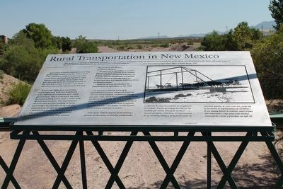
Rural Transportation in New Mexico
Agriculture is heavily dependent on having good transportation networks. With a good road, a producer carried a larger load and made fewer trips hauling his goods to town. Without one, he often had to move (and sell) his crops when the road was passable or the river low enough to cross - not always when he could get the best price for his crop.
Prior to the 1920s most rural roads and bridges were built and maintained at the expense of community and county governments. Much of the work was done by residents living near a road - often rural farmers and ranchers. The improvement of rural roads and the building of sturdy steel bridges like this one, along with the establishment of highway departments and a federal road network, marked a major step forward for many rural agricultural communities in the early 20th century.
(Text is repeated in Spanish on the second half of the plaque.)
Credits. This page was last revised on June 16, 2016. It was originally submitted on October 17, 2015, by Jennifer W. of Las Cruces, New Mexico. This page has been viewed 734 times since then and 44 times this year. Photos: 1, 2, 3, 4, 5, 6, 7. submitted on October 17, 2015, by Jennifer W. of Las Cruces, New Mexico. • Andrew Ruppenstein was the editor who published this page.
