Marker Logo HMdb.org THE HISTORICAL
MARKER DATABASE
“Bite-Size Bits of Local, National, and Global History”
Frederick in Frederick County, Maryland — The American Northeast (Mid-Atlantic)
 

Civilians Under Siege

Monocacy National Battlefield


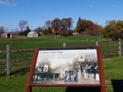
Civilians Under Siege Marker image. Click for full size.
Photographed By Allen C. Browne, November 2, 2014
1. Civilians Under Siege Marker
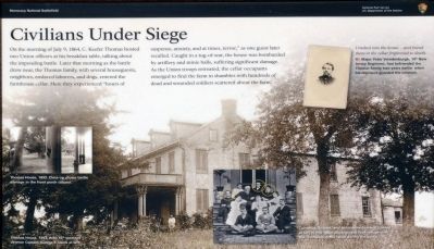
Inscription. On the morning of July 9, 1864, C. Keefer Thomas hosted two Union officers at his breakfast table, talking about the impeding battle. Later that morning as the battle drew near, the Thomas family, with several houseguests, neighbors, enslaved laborers, and dogs, entered the farmhouse cellar.Here they experienced "hours of suspense, anxiety, and at times, terror," as one guest later recalled. Caught in a tug-of-war, the house was bombarded by artillery and minie balls, suffering significant damage. As the Union troops retreated, the cellar occupants emerged to find the farm in shambles with hundreds of dead and wounded soldiers scattered about the farm.
 
Erected by Monocacy National Battlefield.
 
Topics. This historical marker is listed in this topic list: War, US Civil. A significant historical date for this entry is July 9, 1864.
 
Location. 39° 21.425′ N, 77° 23.444′ W. Marker is in Frederick, Maryland, in Frederick County. Marker is on Baker Valley Road, 0.3 miles south of Araby Church Road, on the right when traveling south. Touch for map. Marker is at or near this postal address: 4486 Baker Valley Road, Frederick MD 21704, United States of America. Touch for directions.
 
Other nearby markers. At least 8 other markers are within walking distance of this marker. Final Attack (here, next to this marker); 10th Vermont Monument (approx. 0.3 miles away); State of Pennsylvania Monument
Paid Advertisement
Click on the ad for more information.
Please report objectionable advertising to the Editor.
Click or scan to see
this page online
(approx. 0.3 miles away); Final Stand (approx. 0.3 miles away); Clustered Spires of Frederick (approx. half a mile away); History of the Monocacy River Valley (approx. half a mile away); The Battle That Saved Washington (approx. half a mile away); Ambush (approx. 0.7 miles away). Touch for a list and map of all markers in Frederick.
 
More about this marker. This marker replaced an older marker at this location titled, "Thomas Farm" (see nearby markers)
 
Civilians Under Siege Marker image. Click for full size.
Photographed By Allen C. Browne, November 2, 2014
2. Civilians Under Siege Marker
Major Peter Vandenburgh image. Click for full size.
Photographed By Allen C. Browne, November 2, 2014
3. Major Peter Vandenburgh
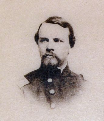
I rushed into the house...and found them in the cellar frightened to death. - Major Peter Vrendenburgh, 14th New Jersey Regiment, had befriended the Thomas family two years earlier when his regiment guarded the junction.
Close-up of photo on marker
Thomas House, 1893. image. Click for full size.
Photographed By Allen C. Browne, November 2, 2014
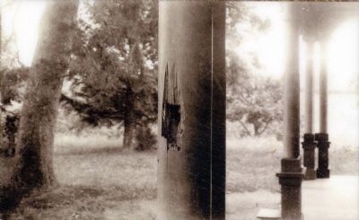
4. Thomas House, 1893.
Close-up shows battle damage in front porch column.
Close-up of photo on marker
Thomas House, 1893 image. Click for full size.
Photographed By Allen C. Browne, November 2, 2014
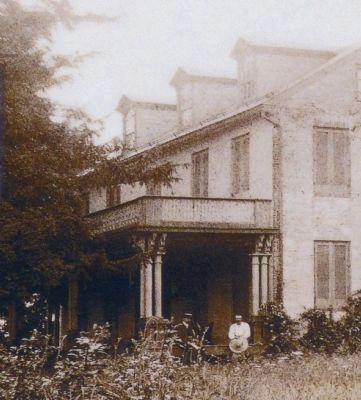
5. Thomas House, 1893
with 10th Vermont veteran Captain George E. Davis at left.
Close-up of photo on marker
Neighbors image. Click for full size.
Photographed By Allen C. Browne, November 2, 2014
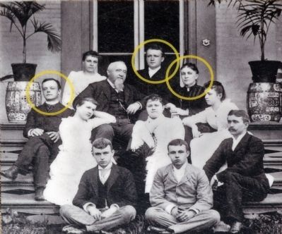
6. Neighbors
Cornelius, Richard, and Antoinette Gambrill (circled at left in this 1880's photograph) took refuge with the Thomases in the cellar during the battle.
Close-up of photo on map
Araby - The Thomas Farm image. Click for full size.
Photographed By Allen C. Browne, November 2, 2014
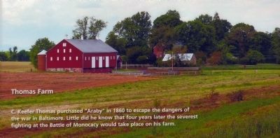
7. Araby - The Thomas Farm
C. Keefer Thomas purchased "Araby" in 1860 to escape the dangers of the war in Baltimore. Little did he know that four years later the severest fighting of the Battle of Monocacy would take place on his farm.
Close-up of image on nearby "Bold Plan" marker
Trail Map<br>You Are Here image. Click for full size.
Photographed By Allen C. Browne, November 2, 2014
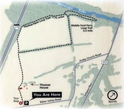
8. Trail Map
You Are Here
Close-up of map on nearby trail marker
 
 
Credits. This page was last revised on June 16, 2016. It was originally submitted on November 4, 2014, by Allen C. Browne of Silver Spring, Maryland. This page has been viewed 709 times since then and 14 times this year. Last updated on October 26, 2015, by Shane Oliver of Richmond, Virginia. Photos:   1, 2, 3, 4, 5, 6, 7, 8. submitted on November 4, 2014, by Allen C. Browne of Silver Spring, Maryland. • Bill Pfingsten was the editor who published this page.
Share this page.  
Share on Tumblr
m=89983

CeraNet Cloud Computing sponsors the Historical Marker Database.
This website earns income from purchases you make after using our links to Amazon.com. We appreciate your support.
Paid Advertisement
Apr. 24, 2024