Near Sinclair in Carbon County, Wyoming — The American West (Mountains)
Fort Fred Steele State Historic Site
Inscription.
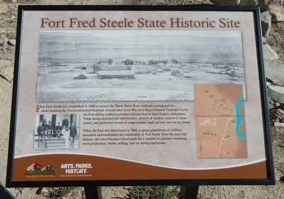
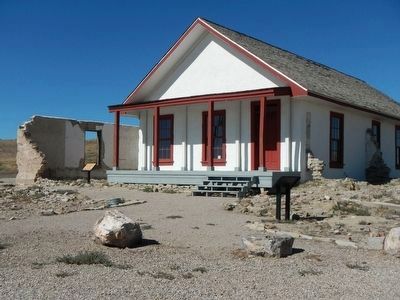
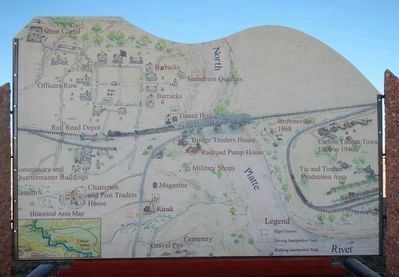
Fort Fred Steele was established in 1868 to protect the North Platte River railroad crossing and the crews builting the Transcontinental Railroad. Named after Civil War hero Major Frederick Steele, the Fort and its soldiers provided vital services to local frontier settlements. These duties included law enforcement, pursuit of rustlers, control of labor unrest, and protective escorts of stagecoaches, mail carriers, and survey teams.
When the Fort was abandoned in 1886, a sparse population of civilians remained and established the community of Fort Steele. Over the next half century, the town became the focal point for a number of activities including wool production, timber milling, and ice cutting operations.
Erected by Wyoming State Parks & Cultural Resources.
Topics. This historical marker is listed in this topic list: Forts and Castles.
Location. 41° 46.496′ N, 106° 56.975′ W. Marker is near Sinclair, Wyoming, in Carbon County. Marker can be reached from County Route 347 near Interstate 80, on the left when traveling north. Touch for map. Marker is in this post office area: Sinclair WY 82334, United States of America. Touch for directions.
Other nearby markers. At least 8 other markers are within walking distance of this marker. Early Construction (a few steps from this marker); Fenimore Chatterton (about 700 feet away, measured in a direct line); A Tourist's Railroad (about 700 feet away); Cemetery (about 700 feet away); Powder Magazine (about 700 feet away); Sheepherder's Community (approx. 0.2 miles away); Ranching (approx. 0.2 miles away); Sheep Ranching (approx. 0.2 miles away). Touch for a list and map of all markers in Sinclair.
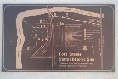
More about this marker. The marker is at the Fort Steele Visitors Center and Museum located to the left off of County Road 374.
Credits. This page was last revised on June 16, 2016. It was originally submitted on October 27, 2015, by Barry Swackhamer of Brentwood, California. This page has been viewed 396 times since then and 11 times this year. Photos: 1, 2, 3, 4. submitted on October 27, 2015, by Barry Swackhamer of Brentwood, California.


