Near Sinclair in Carbon County, Wyoming — The American West (Mountains)
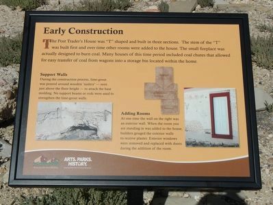
Early Construction
Support Walls
During the construction processes, lime-grout was poured around wooden 'nailers' - seen just above the floor height - to attach the base moulding. No support beams or rods were used to strengthen the lime-grout walls.
Adding Rooms
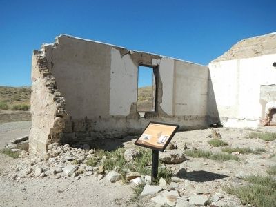
At one time the wall on the right was an exterior wall. When the room you are standing in was added to the house, builders gouged the exterior wall to receive plaster. Exterior windows were removed and replace with doors during the addition of the room.
Erected by Wyoming State Parks & Cultural Resources.
Topics. This historical marker is listed in these topic lists: Forts and Castles • Industry & Commerce.
Location. 41° 46.49′ N, 106° 56.982′ W. Marker is near Sinclair, Wyoming, in Carbon County. Marker can be reached from County Route 347 near Interstate 80 , on the left when traveling north. Touch for map. Marker is in this post office area: Sinclair WY 82334, United States of America. Touch for directions.
Other nearby markers. At least 8 other markers are within walking distance of this marker. Fort Fred Steele State Historic Site (a few steps from this marker); Fenimore Chatterton (about 700 feet away, measured in a direct line); A Tourist's Railroad (about 700 feet away); Cemetery (about 700 feet away); Powder Magazine (about 700 feet away); Sheepherder's Community (approx. 0.2 miles away); Ranching (approx. 0.2 miles away); Sheep Ranching (approx. 0.2 miles away). Touch for a list and map of all markers in Sinclair.
More about this marker. This marker is found at Fort Fred Steele State Historic Site Visitors Center & Museum located off of County Road 347.
Credits. This page was last revised on June 16, 2016. It was originally submitted on October 27, 2015, by Barry Swackhamer of Brentwood, California. This page has been viewed 307 times since then and 6 times this year. Photos: 1, 2. submitted on October 27, 2015, by Barry Swackhamer of Brentwood, California.

