Cobourg in Northumberland County, Ontario — Central Canada (North America)
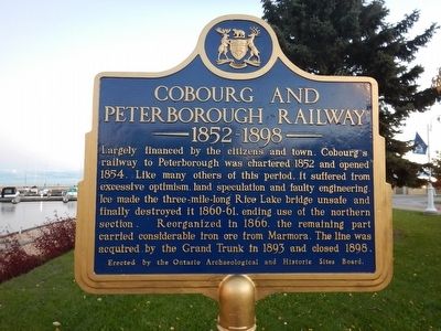
Cobourg and Peterborough Railway
1852-1898
Largely financed by the citizens and town, Cobourg's railway to Peterborough was chartered 1852 and opened 1854. Like many others of this period, it suffered from excessive optimism, land speculation and faulty engineering. Ice made the three-mile-long Rice Lake bridge unsafe and finally destroyed it 1860–61, ending use of the northern section. Reorganized in 1866, the remaining part carried considerable iron ore from Marmora. The line was acquired by the Grand Trunk in 1893 and closed 1898.
Erected by Ontario Archaeological and Historic Sites Board.
Topics. This historical marker is listed in this topic list: Railroads & Streetcars. A significant historical year for this entry is 1852.
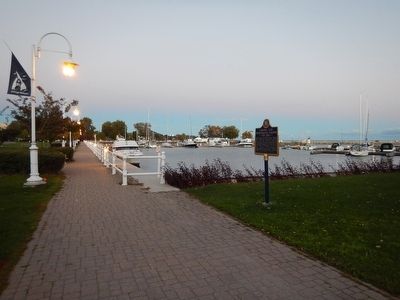
Location. 43° 57.413′ N, 78° 10.035′ W. Marker is in Cobourg, Ontario, in Northumberland County. Marker is on 3rd Street, 0.2 kilometers south of Albert Street, on the left when traveling south. Marker is located adjacent the Cobourg Marina. Touch for map. Marker is in this post office area: Cobourg ON K9A 5X2, Canada. Touch for directions.
Other nearby markers. At least 8 other markers are within walking distance of this marker. The Founding of Cobourg (here, next to this marker); Victoria Hall (approx. 0.3 kilometers away); a different marker also named Victoria Hall (approx. 0.3 kilometers away); William Weller (approx. half a kilometer away); Ryerson Walk (approx. 0.6 kilometers away); Marie Dressler (approx. 0.6 kilometers away); Church of St. Peter (approx. 0.6 kilometers away); Victoria College (approx. one kilometer away). Touch for a list and map of all markers in Cobourg.
Also see . . . Cobourg and Peterborough Railway. Wikipedia entry (Submitted on October 5, 2022, by Larry Gertner of New York, New York.)
Credits. This page was last revised on October 5, 2022. It was originally submitted on October 30, 2015, by Kevin Craft of Bedford, Quebec. This page has been viewed 291 times since then and 49 times this year. Photos: 1, 2. submitted on October 30, 2015, by Kevin Craft of Bedford, Quebec.

