Cobourg in Northumberland County, Ontario — Central Canada (North America)
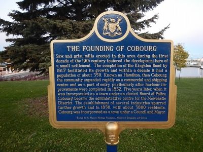
The Founding of Cobourg
Saw and grist mills erected in this area during the first decade of the 19th century fostered the development here of a small settlement. The completion of the Kingston Road by 1817 facilitated its growth and within a decade it had a population of about 350. Known as Hamilton, then Cobourg, the community expanded rapidly as a commercial and shipping centre and as a port of entry, particularly after harbour improvements were completed in 1832. Five years later, when it was incorporated as a town under an elected Board of Police, Cobourg became the administrative center for the Newcastle District. The establishment of several industries spurred further growth and in 1850, with about 3800 residents, Cobourg was incorporated as a town under a Council and Mayor.
Erected by Ontario Heritage Foundation.
Topics. This historical marker is listed in these topic lists: Industry & Commerce • Roads & Vehicles • Settlements & Settlers.
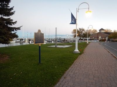
Location. 43° 57.409′ N, 78° 10.037′ W. Marker is in Cobourg, Ontario, in Northumberland County. Marker is on 3rd Street, 0.2 kilometers south of Albert Street, on the left when traveling south. Marker is located adjacent the Cobourg Marina. Touch for map. Marker is at or near this postal address: 103 3rd Street, Cobourg ON K9A 5W9, Canada. Touch for directions.
Other nearby markers. At least 8 other markers are within walking distance of this marker. Cobourg and Peterborough Railway (here, next to this marker); Victoria Hall (approx. 0.3 kilometers away); a different marker also named Victoria Hall (approx. 0.3 kilometers away); William Weller (approx. half a kilometer away); Ryerson Walk (approx. 0.6 kilometers away); Marie Dressler (approx. 0.6 kilometers away); Church of St. Peter (approx. 0.6 kilometers away); Victoria College (approx. one kilometer away). Touch for a list and map of all markers in Cobourg.
Credits. This page was last revised on October 2, 2019. It was originally submitted on October 30, 2015, by Kevin Craft of Bedford, Quebec. This page has been viewed 241 times since then and 11 times this year. Photos: 1, 2. submitted on October 30, 2015, by Kevin Craft of Bedford, Quebec.

