Near Green River in Sweetwater County, Wyoming — The American West (Mountains)
All Because of an Ancient Lake
Trona Trail Historic Mine Byway

Photographed By Barry Swackhamer, September 10, 2015
1. All Because of an Ancient Lake Marker
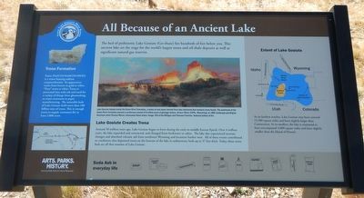
Captions: (center) Lake helped create the Green River Formation, a series of rock layers formed from lake sediment that contains may fossils. The sediments of the Green River Formation present a continuous record of 6 million years of geological history. Green River Cliffs, Wyoming an 1881 landscaper painting by American artist Thomas Moran, showcases these strata.; (right side-bar) (Map showing the extent of Lake Gosiute); (left side-bar) (Trona mineral).
Lake Gosiute Creates Trona
Around 50 million years ago, Lake Gosiute began to form during the early-to-middle Eocene Epoch. Over 4 million years, the lake expanded and contracted, and changed from freshwater to saline. The lake also experienced tectonic changes and absorbed volcanic ash from northwest Wyoming and locations further west. All of these events contributed to conditions that deposited trona on the bottom of the lake in sedimentary beds up to 37 feet thick. Today, these trona beds are all that remain of Lake Gosiute.
Side-bar on the right
Extent of Lake Gosiute
At its furthest reaches, Lake Gosiute many have covered 15,500 square miles and been slightly larger than Connecticut. At is smallest, the lake is estimated to have encompassed 4,000 square miles and been slightly smaller than the Island of Hawaii.
Side-bar on the left
Trona Formation
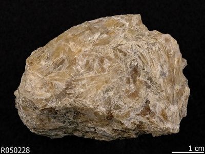
Trona (Na2CO3•NaHCO3•2H3O) is a water-bearing sodium sesquicarbonate. Its appearance varies from brown to gold to white. "Pure" trona is white. Trona is processed into soda ash and used for a variety of things from glassmaking to water treatment to paper manufacturing. The mineable beds of Lake Gosiute hold more than 100 billion tons of trona. This is enough trona to supply customers for at least 2,000 years.
Erected by Wyoming State Parks & Cultural Resources.
Topics. This historical marker is listed in these topic lists: Industry & Commerce • Natural Resources • Paleontology.
Location. 41° 26.184′ N, 109° 31.896′ W. Marker is near Green River, Wyoming, in Sweetwater County. Marker is on State Highway 530 near Peru Cutoff Road (County Route 37), on the left when traveling south. Touch for map. Marker is in this post office area: Green River WY 82935, United States of America. Touch for directions.
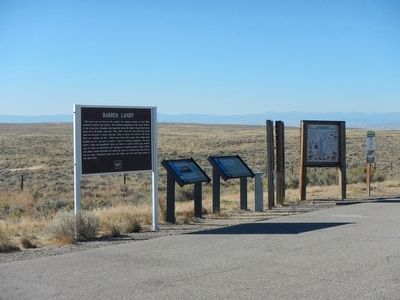
Other nearby markers. At least 8 other markers are within 7 miles of this marker, measured as the crow flies. Barren Land? (a few steps from this marker); The Overland Stage (approx. 6½ miles away); The Overland Stage Station Route (approx. 6½ miles away); Sodium Carbonate Brine (approx. 6.7 miles away); William Manly - 1849 (approx. 6.8 miles away); The Great Unknown (approx. 6.8 miles away); William Ashley - 1825 (approx. 6.8 miles away); John Wesley Powell, 1871 (approx. 6.8 miles away). Touch for a list and map of all markers in Green River.
Also see . . . Trona - Wikipedia.
(Submitted on October 30, 2015, by Barry Swackhamer of Brentwood, California.)

Photographed By Barry Swackhamer, September 10, 2015
4. Trona Trail Historic Mine Byway information panel.
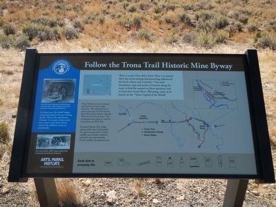
Follow the Trona Trail Historic Mine Byway
What is trona? How did it form? How has trona mining and processing influenced the local culture and economy? Visit each sign and points of interest along the route to find the answers to these questions and to learn how Green River, Wyoming, came to be known as the "Trona Capital of the World."
Trona Trail has two access points and may be traveled in either direction. The eastbound access point is just east of Little America. Exit I-80 at Little America and take Wyoming 374 to Green River. The westbound access point is south of Green River on WYO 530
Be advised that the Peru Cutoff segment of the Trona Trail includes an unpaved county road. Consider carefully recent weather conditions and vehicle size when deciding whether to follow this optional route.
Side-bar on the left
Far below you, the world's largest and purest deposit of trona is being mined. What is the significance of trona? It is used to make nearly every item in you home and to control the pollution in the air you breath.
Captions: (left side-bar, top) Stauffer Chemical Company (now OCI) mining near Green River, 1962.' (left side-bar, bottom) Trona mine interior, 1989.
Credits. This page was last revised on June 16, 2016. It was originally submitted on October 30, 2015, by Barry Swackhamer of Brentwood, California. This page has been viewed 756 times since then and 52 times this year. Photos: 1, 2, 3, 4. submitted on October 30, 2015, by Barry Swackhamer of Brentwood, California.

