Surfside Beach in Brazoria County, Texas — The American South (West South Central)
Gulf Intracoastal Waterway
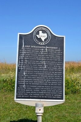
This complex of barge canals and natural channels—most valuable waterway in America—stretches 1,116 mi. from Brownsville, Texas, to St. Mark’s, Florida. Is longer, carries more tonnage than Suez and Panama canals. Is a vital link in economy of Texas and has been one of main causes of rapid development of Gulf Coast area.
The canal system was begun in 1854 when a short canal was built from Galveston Bay to mouth of Brazos River as aid to Texas trade; it was 50 ft. wide, 3 ½ ft. deep and dug by hand-labor and mule teams. Later projects widened, lengthened canal along the coast.
Most important period in growth of the waterway system was result of determined efforts by two Texas businessmen, Clarence S.E. Holland and Roy Miller. In 1905-1907 these men organized the initial financial support, arranged construction and won Congressional backing for canal improvements. By 1966 annual total tonnage of the waterway exceeded 78,500,000 tons.
Hundreds of companies now have plants or warehouses along the canal; its impact on growth of Gulf Coast has been immense. Several inland cities have become seaports; canal helped to make Houston nation’s third largest port. Low shipping costs created by waterway have brought prosperity to entire Texas Gulf Coast.
Erected 1967 by State Historical Survey Committee. (Marker Number 9564.)
Topics. This historical marker is listed in these topic lists: Industry & Commerce • Waterways & Vessels. A significant historical year for this entry is 1854.
Location. 28° 57.05′ N, 95° 17.165′ W. Marker is in Surfside Beach, Texas, in Brazoria County. Marker can be reached from the intersection of State Highway 332 and Bluewater Highway (County Road 257). Marker is located on an unnamed street 0.1 miles southeast of the intersection of SH 332, the Bluewater Highway, and Fort Velasco Drive. Touch for map. Marker is in this post office area: Freeport TX 77541, United States of America. Touch for directions.
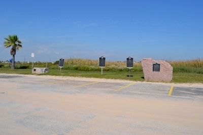
Other nearby markers. At least 8 other markers are within one mile of this marker, measured as the crow flies. Old Velasco, CSA (here, next to this marker); Velasco (a few steps from this marker); Historical Jetties (a few steps from this marker); The Lively (approx. one mile away); Battle of Velasco Memorial (approx. one mile away); The San Felipe Incident (approx. one mile away); Republic of Texas Battery (approx. 1.1 miles away); Confederate Civil War Forts at Mouth of Brazos (approx. 1.1 miles away). Touch for a list and map of all markers in Surfside Beach.
Also see . . . Gulf Intracoastal Waterway. From the Texas State Historical Association’s “Handbook of Texas Online”. (Submitted on October 31, 2015.)
Credits. This page was last revised on November 27, 2020. It was originally submitted on October 31, 2015, by Duane Hall of Abilene, Texas. This page has been viewed 790 times since then and 104 times this year. Photos: 1, 2, 3, 4. submitted on October 31, 2015, by Duane Hall of Abilene, Texas.


