Simpsonville in Greenville County, South Carolina — The American South (South Atlantic)
Hopkins Farm
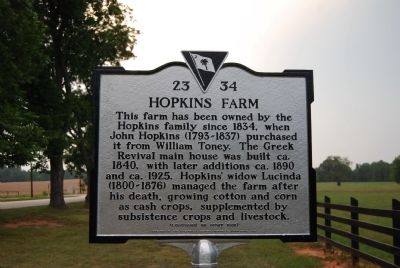
This farm has been owned by the Hopkins family since 1834, when John Hopkins (1793-1837) purchased it from William Toney. The Greek Revival main house was built ca. 1840, with later additions ca. 1890 and ca. 1925. Hopkins' widow, Lucinda (1800-1876) managed the farm after his death, growing cotton and corn as cash crops, supplemented by subsistence crops and livestock.
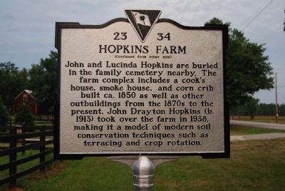
[Marker Reverse]:
John and Lucinda Hopkins are buried in the family cemetery nearby. This farm complex includes a cook's house, smoke house, and corn crib built ca. 1850 as well as other outbuildings from the 1870s to the present. John Drayton Hopkins (b. 1913) took over the farm in 1938, making it a model of modern soil conservation techniques such as terracing and crop rotation.
Erected 2007 by Greenville County Historical Commission. (Marker Number 23-34.)
Topics. This historical marker is listed in these topic lists: Agriculture • Notable Buildings. A significant historical year for this entry is 1834.
Location. 34° 39.355′ N, 82° 18.995′ W. Marker is in Simpsonville, South Carolina, in Greenville County. Marker is on Fork Shoals Road (State Highway 23-146) south of Old Hundred Road (State Highway 23-459). Touch for map. Marker is at or near this postal address: 3717 Fork Shoals Rd, Simpsonville SC 29680, United States of America. Touch for directions.
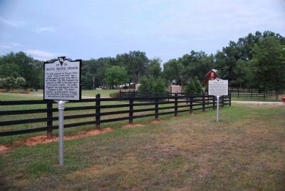
Other nearby markers. At least 8 other markers are within 4 miles of this marker, measured as the crow flies. Toney's Store / Militia Muster Ground (here, next to this marker); Battle of Great Cane Brake (within shouting distance of this marker); Old Livestock Corral (approx. 2.2 miles away); Reese Family Cemetery (approx. 2.2 miles away); Fork Shoals Baptist Church (approx. 2˝ miles away); Fork Shoals School (approx. 2˝ miles away); Environment – Cedar Falls Park (approx. 3.2 miles away); History - Cedar Falls Park (approx. 3.2 miles away). Touch for a list and map of all markers in Simpsonville.
Regarding Hopkins Farm. The Hopkins Farm is a private residence located about 1/4 mile off the road. It is listed on the National Register of Historic Places.
Credits. This page was last revised on June 16, 2016. It was originally submitted on July 9, 2008, by Brian Scott of Anderson, South Carolina. This page has been viewed 3,699 times since then and 54 times this year. Last updated on July 11, 2008, by Brian Scott of Anderson, South Carolina. Photos: 1, 2, 3. submitted on July 9, 2008, by Brian Scott of Anderson, South Carolina. • Kevin W. was the editor who published this page.


