Near Breaks in Dickenson County, Virginia — The American South (Mid-Atlantic)
The Crooked Road
— The Crooked Road — Virginia’s Heritage Music Trail —
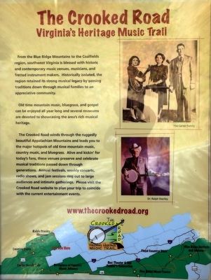
Old time mountain music, bluegrass, and gospel can be enjoyed all year long and several museums are devoted to showcasing the area’s rich musical heritage.
The Crooked Road winds through the ruggedly beautiful Appalachian Mountains and leads you to the major hotspots of old time mountain, music country music, and bluegrass. Alive and kickin’ for today’s fans, these venues preserve and celebrate musical traditions passed down through generations. Annual festivals, weekly concerts, radio shows, and jam sessions ring out to large audiences and intimate gatherings. Please visit the Crooked Road website to plan your trip to coincide with the current entertainment events.
Erected by The Crooked Road.
Topics and series. This historical marker is listed in these topic lists: Arts, Letters, Music • Entertainment. In addition, it is included in the The Crooked Road: Virginia’s Heritage Music Trail series list.
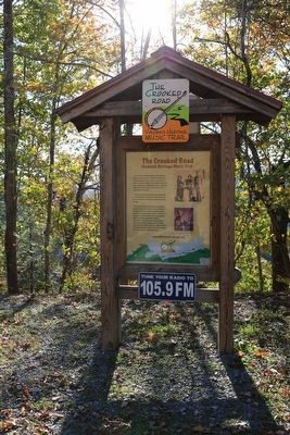
Location. 37° 16.967′ N, 82° 17.31′ W. Marker is near Breaks, Virginia, in Dickenson County. Marker is on Virginia Route 80, one mile Breaks. It is at the Mill Rock Point Overlook pull-off parking lot. Touch for map. Marker is in this post office area: Breaks VA 24607, United States of America. Touch for directions.
Other nearby markers. At least 8 other markers are within 2 miles of this marker, measured as the crow flies. Mill Rock Point Overlook (a few steps from this marker); Mill Rock Point (within shouting distance of this marker); Formation Of The Breaks (approx. 0.3 miles away); Salt Kettle (approx. half a mile away); Early Settlement (approx. half a mile away); The Name Breaks (approx. 0.8 miles away); Clinchfield Overlook (approx. 0.9 miles away); Known But to God (approx. 1.7 miles away in Kentucky). Touch for a list and map of all markers in Breaks.
More about this marker. The Crooked Road winds through the Virginia mountains from this point southwest and then east to Franklin County. Check out the map at the bottom of the marker.
Also see . . .
1. The Crooked Road: Virginia’s Heritage Music Trail. (Submitted on November 17, 2015.)
2. American Old-Time Music Alive, Thriving in Rural Virginia.
Credits. This page was last revised on September 11, 2017. It was originally submitted on November 17, 2015, by J. J. Prats of Powell, Ohio. This page has been viewed 485 times since then and 18 times this year. Photos: 1, 2, 3. submitted on November 17, 2015, by J. J. Prats of Powell, Ohio.


