Near Montpelier in Bear Lake County, Idaho — The American West (Mountains)
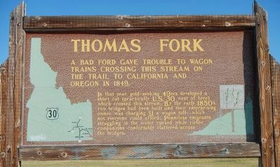
Thomas Fork
In that year, gold-seeking 49'ers developed a shortcut that crossed here. Then emigrants built two bridges here in 1850. But an enterprising toll collector came along and charged $1 per wagon, which was more than some could afford. Penniless emigrants, who had to make an eight-mile detour, cursed, while their richer companions comfortably clattered across both bridges.
Erected by Idaho Historical Society and Idaho Transportation Department. (Marker Number 157.)
Topics and series. This historical marker is listed in these topic lists: Roads & Vehicles • Settlements & Settlers. In addition, it is included in the Idaho State Historical Society, and the Oregon Trail series lists.
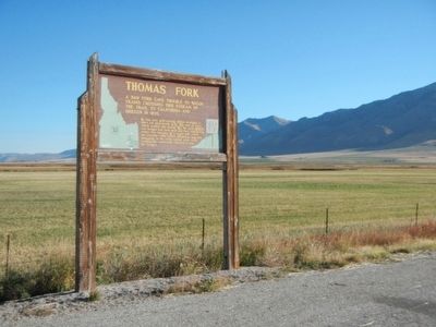
Location. 42° 12.846′ N, 111° 3.99′ W. Marker is near Montpelier, Idaho, in Bear Lake County. Marker is on U.S. 30 at milepost 454.5 near Walter Lane, on the right when traveling west. Touch for map. Marker is in this post office area: Montpelier ID 83254, United States of America. Touch for directions.
Other nearby markers. At least 8 other markers are within 9 miles of this marker, measured as the crow flies. Golden Anniversary 1940 (approx. one mile away in Wyoming); Oregon Trail 1847 (approx. one mile away in Wyoming); One Continual Stream (approx. 8.7 miles away); Idaho's Emigrant Trails (approx. 8.7 miles away); Hot, Cold, Dry, Wet, Dusty, 2,000-Mile Trail (approx. 8.7 miles away); Big Hill (approx. 8.7 miles away); Big Hill... (approx. 8.7 miles away); a different marker also named Big Hill (approx. 8.7 miles away). Touch for a list and map of all markers in Montpelier.
Credits. This page was last revised on June 16, 2016. It was originally submitted on November 21, 2015, by Barry Swackhamer of Brentwood, California. This page has been viewed 1,712 times since then and 125 times this year. Photos: 1, 2. submitted on November 21, 2015, by Barry Swackhamer of Brentwood, California.

