Mechanicsville in Hanover County, Virginia — The American South (Mid-Atlantic)
June 3, 1864 — 18th Corps: A Disastrous Attack
Inscription.
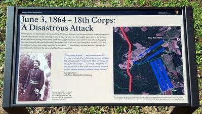
General John H. Martindale’s division of the 18th Corps deployed on this ground prior to its participation in the Federal attack on the morning of June 3, 1864. At 4:30 a.m., the roughly 3,400 men of the division advanced toward strong Confederate earthworks, approximately 1,000 yards in front of you. Charging into concentrated rifle and artillery fire, Benjamin Hett of the 12th New Hampshire recalled, “The men went down in rows, just as they marched in the ranks….” Martindale’s division absorbed perhaps the most complete defeat of the day and suffered 1,043 casualties.
“Everything is quiet…such occasions as this…try men’s nerves. Every face was more or less pale, but all had a determined look. Thus we stood, all ready for the charge…it seemed a long time to me, for at such a time with men’s nerves strained to their utmost tension, a minute seems an hour.”
George Place, 12th New Hampshire Infantry
(captions)
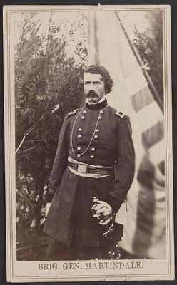
General Martindale led a brigade when the Union army fought around Richmond in 1862. Just two years later, he commanded a division at Cold Harbor.
This aerial photograph shows the ground that Martindale’s two brigades had to cross on June 3, 1864. The Union soldiers advanced into fire that converged from three directions. The green lines indicate preserved battlefield land.
Erected 2015 by Richmond National Battlefield Park.
Topics. This historical marker is listed in this topic list: War, US Civil. A significant historical date for this entry is June 3, 1864.
Location. 37° 35.961′ N, 77° 16.752′ W. Marker is in Mechanicsville, Virginia, in Hanover County. Marker is at the intersection of Beulah Church Road (Virginia Route 633) and Glenharbor Lane, on the left when traveling north on Beulah Church Road. Touch for map. Marker is in this post office area: Mechanicsville VA 23111, United States of America. Touch for directions.
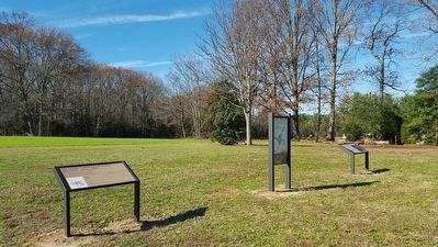
Other nearby markers. At least 8 other markers are within walking distance of this marker. Cold Harbor: The Early Actions (here, next to this marker); The Armies Gather at Cold Harbor (a few steps from this marker); Keitt’s Attack — Morning, June 1, 1864 (approx. 0.2 miles away); In Reserve (approx. half a mile away); Union Earthworks (approx. half a mile away); The Cold Harbor Killing Fields (approx. 0.6 miles away); Grant's Grand Assault (approx. 0.6 miles away); Tomb of the Unknown Soldier (approx. 0.7 miles away). Touch for a list and map of all markers in Mechanicsville.
Credits. This page was last revised on June 16, 2016. It was originally submitted on November 22, 2015, by Bernard Fisher of Richmond, Virginia. This page has been viewed 494 times since then and 19 times this year. Photos: 1, 2, 3. submitted on November 22, 2015, by Bernard Fisher of Richmond, Virginia.


