Near Dickensonville in Russell County, Virginia — The American South (Mid-Atlantic)
Jessee’s Mill
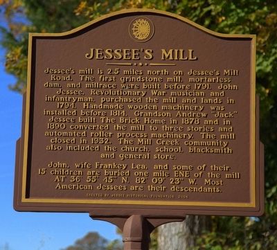
Jessee's mill is 2.5 miles north on Jessee’s Mill Road. The first grindstone mill, mortarless dam, and millrace were built before 1794. John Jessee, Revolutionary War musician and infantryman, purchased the mill and lands in 1724. Handmade wooden machinery was installed before 1814. Grandson Andrew “Jack” Jessee built The Brick Home in 1878 and in 1890 converted the mill to three stories and automated roller process machinery. The mill closed in 1932. The Mill Creek community also included the church, school, blacksmith and general store.
John, wife Frankey Lea and some of their 15 children are buried one mile east-northeast of the mill At 36° 55' 45" N, 82° 09' 23" W. Most American Jessees are their descendants.
Erected 2004 by Jessee Historical Foundation.
Topics. This historical marker is listed in these topic lists: Industry & Commerce • Notable Buildings. A significant historical year for this entry is 1794.
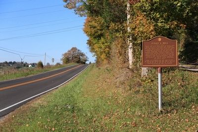
Location. 36° 53.026′ N, 82° 9.296′ W. Marker is near Dickensonville, Virginia, in Russell County. Marker is on Virginia Route 71 near Jessees Mill Road (County Route 645), on the left when traveling north. Touch for map. Marker is in this post office area: Cleveland VA 24225, United States of America. Touch for directions.
Other nearby markers. At least 8 other markers are within 10 miles of this marker, measured as the crow flies. Glade Hollow Fort (approx. 2.2 miles away); Russell Courthouse (approx. 4.3 miles away); Russell County / Washington County (approx. 5.2 miles away); Old Russell County Courthouse (approx. 5.8 miles away); Russell’s Fort (approx. 6.6 miles away); Dorton’s Fort (approx. 8.6 miles away); Veterans Memorial (approx. 8.8 miles away); Moore’s Fort (approx. 9.9 miles away). Touch for a list and map of all markers in Dickensonville.
Also see . . . Jessee’s Mill. Virginia Department of Historic Resources website entry:
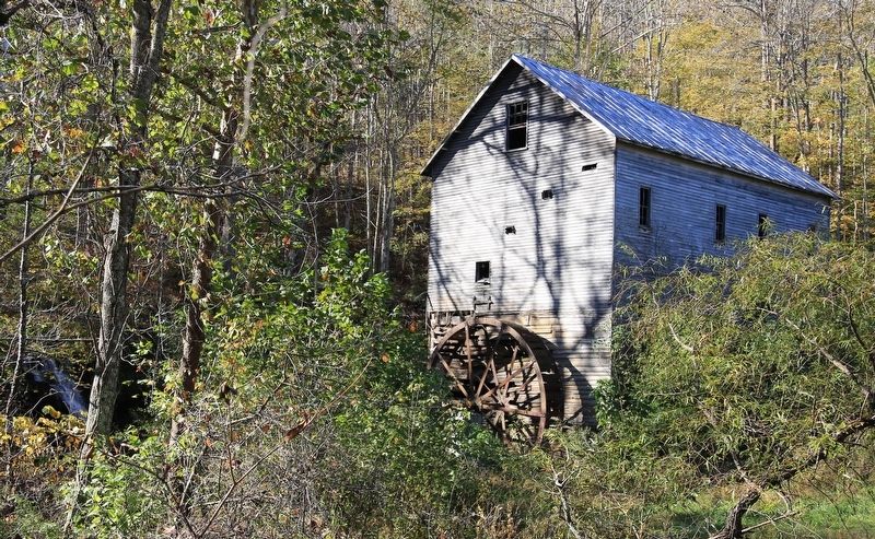
The earliest part of the mill is a weatherboarded two-story, one-room structure of massive hardwood logs, hand hewn on two sides and V-notched at the corners, set upon an embanked foundation of dry-laid, roughly cut and uncut stone. The entire log structure now comprises the basement of the existing mill building. It was rectangular in plan, measuring 18 ft. by 30ft., and was proportionally quite tall in its original form, with at least two stories and an attic space. It had window openings on the first and second levels on the north and south elevations, but none on the east elevation. Early-period sawn weatherboards, untapered and irregular in both length and width, survive only on the east elevation. The other two sides have c.1897 un-beaded yellow-poplar weatherboards that match the upper floors of the enlarged structure. Many are fastened with cut nails, some with wire nails. Centered on the east elevation, the 20-foot, all steel Fitz overshot water wheel, which likely replaced an original iron and wood wheel, is now rusted and mired in alluvium. The main power shaft protrudes from the wall just above the sill log, about 8 ft. above present ground surface. On the interior, there is no floor at the sill level because the entire space is occupied by the main shaft and gears, all supported by the massive heavy timber hurst frame. The hurst frame is entirely independent of the building in order to minimize vibrations. Satellite gears once drove the pair of millstones and later were connected to belt wheels that powered the roller equipment in the upper levels. The spur wheel and other wheels are made of oak laid cross-grained for double strength, and pegged with dowels. The cogs were also hand-chiseled from oak.
Like many other gristmills of the period, Jessees Mill is now four stories tall in order for the milling process to use gravity to full advantage. The c.1897 section of the mill added several times to the building’s mass. It consists of a light balloon frame with heavy corner posts and diagonal bracing. On the medium-pitch gable roof, V-crimped sheet metal panels have replaced 19th C. pressed tin shingles, a few of which can still be found about the mill. The windows, several of which are missing, were primarily 6-over-6 double hung sash with fine muntins.
After 1897, the mill was entered mainly by a doorway at the second floor level, on the uphill (west) side of the building. Just to the right of the doorway once stood a chimney with anexceptionally tall stack, needed to clear the roof. Its shape and dimensions are clearly indicated by differential weathering on the weatherboards. The chimney was constructed of handmade bricks and lime/sand mortar, and served only one hearth, in the small southwest-corner office on the second floor. Fireplaces are said to have been rare in mills because of explosive fine powder atmospheres.
The second floor and third floors house the corn cleaner, wheat cleaner and flour grader or bolter, together with the complex system of bins, hoppers, troughs, shafts, belts, pulleys, and chains powering them via a long belt from the main shaft in the basement.
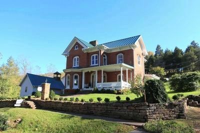
The large, brick, c.1897 Andrew Jackson Jessee House, associated with the mill, is situated on the east side of Route 645, across the road from the mill. The house is notable for its scale, its Queen Anne style characteristics and unusual rusticated brick window arches, as well as its high level of integrity. A late 19th C. frame miller's cottage is sited north of the A.J. Jessee House, also on Rt. 645. The frame Mill Creek Church (mid-20th-century)
lies just to the southwest of the intersection of Rts. 645 & 640, cater-corner from the one-room frame Jessees Mill schoolhouse, which appears to date to the early 20th century. These resources are currently held by other owners, and therefore are not being nominated at this time. (Submitted on November 28, 2015.)
Credits. This page was last revised on February 12, 2022. It was originally submitted on November 28, 2015, by J. J. Prats of Powell, Ohio. This page has been viewed 1,038 times since then and 94 times this year. Photos: 1, 2, 3, 4. submitted on November 28, 2015, by J. J. Prats of Powell, Ohio.
Editor’s want-list for this marker. Photos of the A.J. Jessee House, Mill Creek Church, and Jessees Mill schoolhouse • Can you help?


