Loomis in Placer County, California — The American West (Pacific Coastal)
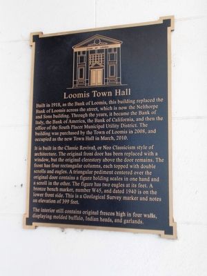
Loomis Town Hall
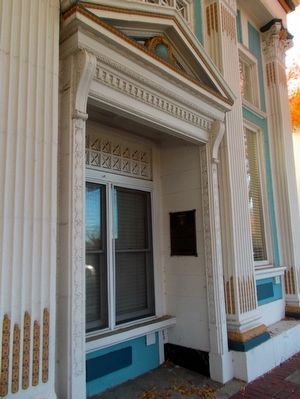
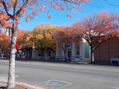
It is built in the Classic Revival, or Neo Classicism style of architecture. The original front door has been replaced with a window, but the original clerestory above the door remains. The front has four rectangular columns, each topped with double scrolls and eagles. A triangular pediment centered over the original door contains a figure holding scales in one hand and a scroll in the other. The figure has two eagles at its feet. A bronze bench marker, number W45, and dated 1940 is on the lower front side. This is a Geological Survey marker and notes an elevation of 399 feet.
The interior still contains original frescoes high in four walls, displaying molded buffalo, Indian heads, and garlands.
Topics. This historical marker is listed in this topic list: Notable Buildings. A significant historical month for this entry is March 2010.
Location. 38° 49.255′ N, 121° 11.626′ W. Marker is in Loomis, California , in Placer County. Marker is on Taylor Road west of Horseshoe Bar Road, on the right when traveling east. Touch for map. Marker is at or near this postal address: 3665 Taylor Road, Loomis CA 95650, United States of America. Touch for directions.
Other nearby markers. At least 8 other markers are within 3 miles of this marker, measured as the crow flies. Loomis (within shouting distance of this marker); A Brief History of the Blue Anchor Shed (within shouting distance of this marker); Loomis - Transcontinental Railroad (within shouting distance of this marker); Liberty Tree Memorial (approx. 0.2 miles away); Loomis Chinatown (approx. 1.1 miles away); Griffith Quarry (approx. 2.6 miles away); The Finnish Temperance Hall (approx. 3 miles away); The Fletcher Moon House (approx. 3 miles away). Touch for a list and map of all markers in Loomis.
Credits. This page was last revised on June 16, 2016. It was originally submitted on November 29, 2015, by Syd Whittle of Mesa, Arizona. This page has been viewed 442 times since then and 26 times this year. Photos: 1, 2, 3. submitted on November 29, 2015, by Syd Whittle of Mesa, Arizona.


