Near Lovell in Big Horn County, Wyoming — The American West (Mountains)
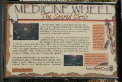
Medicine Wheel
The Sacred Circle
It is perhaps the location of the Medicine Wheel that contributes so powerfully to a feeling of sacredness and agedness. Lying atop Medicine Mountain at nearly 10,00 feet, the weather here is as wild as the towering crags and sheer cliffs that define the mountain. Sleet, rain and snowstorms are common here, even in July. Streaks of jagged lightning, deafening thunder, and wind scream past the rocky embattlements. These are the forces that confronted the people who came here, ages ago, to build a place of ceremony and worship.
Some people believe that the Medicine Wheel is a vision quest site, a representation of the Sun Dance Lodge, a turtle effigy, or a place to mark the summer solstice. You, too, may find this place of renewal.
Side-bar, right:
"When we want wisdom we go up on the mountain and talk to the creator, four days and four nights without food and water. Yes, you can talk to the creator up on the mountain by yourself. You can say anything you want. Nobody is there to listen to you; it is between you and the creator and nobody else. It's a great feeling to be talking to the creator. In know, I have done it way up on the mountain. The wind blowing! It was dark! It was cold! I stood their and talked to the creator." -- Lakota Sioux
Native American Indian people from over eighty tribes use the Medicine Wheel for prayer and traditional ceremonies. Please protect fragile vegetation by walking only on the road and established paths, leave the site and traditional offerings as you found them. Respect the privacy of those here for meditation, inspiration, and solitude.
Erected by Bighorn National Forest, Mary Alice Fortin Foundation of Florida and Big Horn Mountain Medicine Wheel Association.
Topics. This historical marker is listed in these topic lists: Anthropology & Archaeology • Native Americans.
Location. 44° 49.197′ N, 107° 53.948′ W. Marker is near Lovell, Wyoming, in Big Horn County. Marker can be reached from Forest Road 12,, 1.7 miles north of U.S. 14A. Touch for map. Marker is in this post office area: Lovell WY 82431, United States of America. Touch for directions.
Other nearby markers. At least 8 other markers are within 4 miles of this marker, measured as the crow flies. A different marker also named Medicine Wheel (here, next to this marker); Five Springs (approx. 0.8 miles away); Welcome to the Medicine Wheel (approx. 1.2 miles away); Bighorn Basin (approx. 2.6 miles away); Big Horn Basin (approx. 2.7 miles away); a different marker also named Medicine Wheel (approx. 2.9 miles away); Gold Fever (approx. 2.9 miles away); Reconstruction - Finally! (approx. 4.1 miles away). Touch for a list and map of all markers in Lovell.
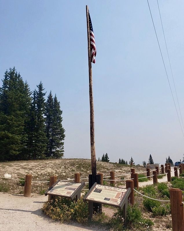
More about this marker. The Medicine Wheel parking lot is at the end of Forest Service Road 12, about 22 miles east of Lovell (milepost 78) via U.S. Highway 14A. This marker is located at the parking lot, at the base of the flagpole near the Visitors Shelter.
Credits. This page was last revised on March 20, 2021. It was originally submitted on December 6, 2015, by Barry Swackhamer of Brentwood, California. This page has been viewed 429 times since then and 33 times this year. Last updated on March 20, 2021, by Craig Baker of Sylmar, California. Photos: 1. submitted on December 6, 2015, by Barry Swackhamer of Brentwood, California. 2. submitted on March 20, 2021, by Craig Baker of Sylmar, California. • J. Makali Bruton was the editor who published this page.
Editor’s want-list for this marker. A mid-distance photo of the marker and its location setting • Can you help?

