Loring Park in Minneapolis in Hennepin County, Minnesota — The American Midwest (Upper Plains)
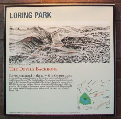
Loring Park: The Devil's Backbone
Image and Text Source: In the Shadow of the City, A History of the Loring Park Neighborhood
Erected 2010.
Topics. This historical marker is listed in this topic list: Notable Places.
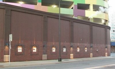
Location. 44° 58.197′ N, 93° 16.726′ W. Marker is in Minneapolis, Minnesota, in Hennepin County. It is in Loring Park. Marker is on Grant Street west of Nicollet Mall, on the right when traveling west. Touch for map. Marker is in this post office area: Minneapolis MN 55403, United States of America. Touch for directions.
Other nearby markers. At least 8 other markers are within walking distance of this marker. Loring Park: Historic Districts and Buildings (here, next to this marker); Loring Park: Basilica and Churches (here, next to this marker); Loring Park: Loring Greenway and Housing (a few steps from this marker); Loring Park: Neighborhood Organizing (a few steps from this marker); Wesley United Methodist Church (about 700 feet away, measured in a direct line); Welcome to the Historic Loring Park Neighborhood (approx. 0.2 miles away); USS Minnesota (BB22) (approx. 0.2 miles away); USS Minneapolis (CA36) (approx. 0.2 miles away). Touch for a list and map of all markers in Minneapolis.
Also see . . .
1. Loring Park, A Minneapolis Neighborhood. (Submitted on December 9, 2015, by William Fischer, Jr. of Scranton, Pennsylvania.)
2. Citizens for a Loring Park Community. (Submitted on December 9, 2015, by William Fischer, Jr. of Scranton, Pennsylvania.)
Credits. This page was last revised on April 24, 2024. It was originally submitted on December 9, 2015, by William Fischer, Jr. of Scranton, Pennsylvania. This page has been viewed 1,145 times since then and 73 times this year. Photos: 1, 2. submitted on December 9, 2015, by William Fischer, Jr. of Scranton, Pennsylvania.

