Marker Logo HMdb.org THE HISTORICAL
MARKER DATABASE
“Bite-Size Bits of Local, National, and Global History”
Budd Lake in Morris County, New Jersey — The American Northeast (Mid-Atlantic)
 

Budd Lake Community


Budd Lake Community Marker image. Click for full size.
Photographed By Don Morfe, December 7, 2015
1. Budd Lake Community Marker
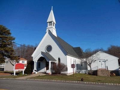
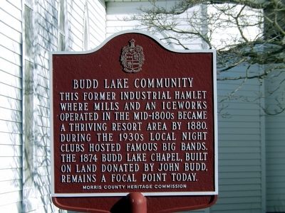
Inscription. This former industrial hamlet where mills and an iceworks operated in the mid-1800s became a thriving resort area by 1880. During the 1930s local night clubs hosted famous big bands. The 1874 Budd Lake Chapel, built on land donated by John Budd, remains a focal point today.
 
Erected 2007 by Morris County Heritage Commission.
 
Topics. This historical marker is listed in these topic lists: Industry & CommerceSettlements & Settlers. A significant historical year for this entry is 1880.
 
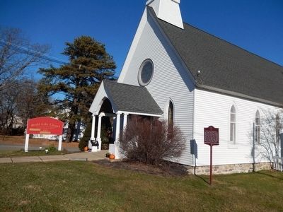
Location. 40° 52.451′ N, 74° 44.23′ W. Marker is in Budd Lake, New Jersey, in Morris County. Marker is on Sands Shore Road. This marker is located in Mt. Olive Twp. and it is in front of the Budd Lake Chapel. Touch for map. Marker is at or near this postal address: 54 Sands Shore Road, Budd Lake NJ 07828, United States of America. Touch for directions.
 
Other nearby markers. At least 8 other markers are within 3 miles of this marker, measured as the crow flies. Mount Olive Village (approx. 1.6 miles away); Veterans Memorial (approx. 2.2 miles away); Morris & Essex Line – Netcong Station (approx. 2.3 miles away); Flanders-Drakestown Road Stone Arch Bridge (approx. 2.3 miles away); Stanhope, New Jersey (approx. 2˝ miles away); The Palace Theatre (approx.
Paid Advertisement
Click on the ad for more information.
Please report objectionable advertising to the Editor.
Click or scan to see
this page online
2˝ miles away); Hugh Allen Mansion (approx. 2˝ miles away); a different marker also named Veterans Memorial (approx. 2˝ miles away).
 
Budd Lake Community Marker image. Click for full size.
Photographed By Don Morfe, December 7, 2015
2. Budd Lake Community Marker
Budd Lake Chapel image. Click for full size.
Photographed By Don Morfe, December 7, 2015
3. Budd Lake Chapel
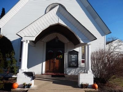
Budd Lake Chapel-close up of the front view image. Click for full size.
Photographed By Don Morfe, December 7, 2015
4. Budd Lake Chapel-close up of the front view
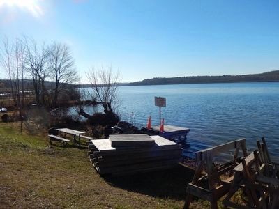
Budd Lake Chapel-directly across the street from Budd Lake image. Click for full size.
Photographed By Don Morfe, December 7, 2015
5. Budd Lake Chapel-directly across the street from Budd Lake
Budd Lake-Birds in the lake image. Click for full size.
Photographed By Don Morfe, December 7, 2015
6. Budd Lake-Birds in the lake
 
 
Credits. This page was last revised on June 16, 2016. It was originally submitted on December 10, 2015, by Don Morfe of Baltimore, Maryland. This page has been viewed 599 times since then and 96 times this year. Photos:   1, 2, 3, 4, 5, 6. submitted on December 10, 2015, by Don Morfe of Baltimore, Maryland. • Bill Pfingsten was the editor who published this page.
Share this page.  
Share on Tumblr
m=91437

CeraNet Cloud Computing sponsors the Historical Marker Database.
This website earns income from purchases you make after using our links to Amazon.com. We appreciate your support.
Paid Advertisement
Apr. 23, 2024