Casper in Natrona County, Wyoming — The American West (Mountains)
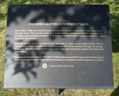
Oregon/California/Mormon Trails
Only two graves in Natrona County are identified by name as trail dated burials. This is unusual due to the fact that hundreds of persons died while traveling through our county. Drowning, disease, and accidents took a toll in our area, especially between this point and Devil’s Gate.
The peak of migration was in 1852 when 70,000 persons passed this spot, most on their way to the California gold fields. These trails contributed to the largest overland migration in history.
Erected by Natrona County Historical Society.
Topics. This historical marker is listed in these topic lists: Roads & Vehicles • Settlements & Settlers.
Location. 42° 50.174′ N, 106° 22.314′ W. Marker is in Casper, Wyoming, in Natrona County. Marker can be reached from Fort Caspar Road, 0.1 miles west of Wyoming Route 258, on the right when traveling west. Touch for map. Marker is at or near this postal address: 4001 Fort Caspar Road, Casper WY 82604, United States of America. Touch for directions.
Other nearby markers. At least 8 other markers are within walking distance of this marker. Military Explorers (here, next to this marker); The Mormons (here, next to this marker); Richard Bridge and Military Complex (here, next to this marker); Robert Stuart Cabin Site (here, next to this marker); Indians Of Wyoming (a few steps from this marker); Pony Express (a few steps from this marker); Bridger and Bozeman Trails (a few steps from this marker); Ranching in Wyoming (a few steps from this marker). Touch for a list and map of all markers in Casper.
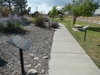
More about this marker. This marker is part of the Wyoming history walk in Centennial Park, which is adjacent to the Fort Caspar Museum and shares the parking lot.
Credits. This page was last revised on January 12, 2021. It was originally submitted on December 19, 2015, by Barry Swackhamer of Brentwood, California. This page has been viewed 423 times since then and 11 times this year. Last updated on January 12, 2021, by Craig Baker of Sylmar, California. Photos: 1, 2. submitted on December 19, 2015, by Barry Swackhamer of Brentwood, California.

