Casper in Natrona County, Wyoming — The American West (Mountains)
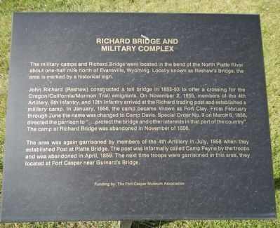
Richard Bridge and Military Complex
John Richard (Reshaw) constructed a toll bridge in 1852-53 to offer a crossing for the Oregon/California/Mormon Trail emigrants. On November 2, 1855, members of the 4th Artillery, 6th Infantry, and 10th Infantry arrived at the Richard trading post and established a military camp. In January, 1856, the camp became known as Fort Clay. From February through June the name was changed to Camp Davis. Special Order No. 9 on March 6, 1856, directed the garrison to ”…protect the bridge and other interests in that part of the country.” The camp at Richard Bridge was abandoned in November of 1856.
The area was again garrisoned by members of the 4th Artillery in July, 1858 when they established Post at Platte Bridge. The post was informally called Camp Payne by the troops and was abandoned in April, 1859. The next time troops were garrisoned in this area, they located at Fort Caspar near Guinard’s Bridge.
Erected by Natrona County Historical Society.
Topics and series. This historical marker is listed in these topic lists: Bridges & Viaducts • Forts and Castles. In addition, it is included in the Oregon Trail series list.
Location. 42° 50.174′ N, 106° 22.319′ W. Marker is in Casper, Wyoming, in Natrona County. Marker can be reached from Fort Caspar Road, 0.1 miles west of Wyoming Route 258, on the right when traveling west. Touch for map. Marker is at or near this postal address: 4001 Fort Caspar Road, Casper WY 82604, United States of America. Touch for directions.
Other nearby markers. At least 8 other markers are within walking distance of this marker. The Mormons (here, next to this marker); Pony Express (here, next to this marker); Bridger and Bozeman Trails (here, next to this marker); Oregon/California/Mormon Trails (here, next to this marker); Ranching in Wyoming (a few steps from this marker); Military Explorers (a few steps from this marker); Goose Egg Ranch (a few steps from this marker); Robert Stuart Cabin Site (a few steps from this marker). Touch for a list and map of all markers in Casper.
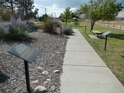
More about this marker. This marker is part of the Wyoming history walk in Centennial Park, which is adjacent to the Fort Caspar Museum and shares the parking lot.
Credits. This page was last revised on January 12, 2021. It was originally submitted on December 25, 2015, by Barry Swackhamer of Brentwood, California. This page has been viewed 614 times since then and 23 times this year. Last updated on January 12, 2021, by Craig Baker of Sylmar, California. Photos: 1, 2. submitted on December 25, 2015, by Barry Swackhamer of Brentwood, California.

