Near Lindale in Smith County, Texas — The American South (West South Central)
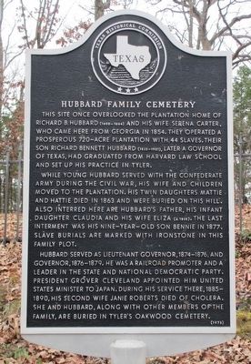
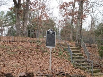
Hubbard Family Cemetery
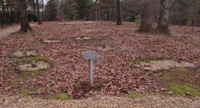
While young Hubbard served with the Confederate army during the Civil War, his wife and children moved to the plantation. His twin daughters Mattie and Hattie died in 1863 and were buried on this hill. Also interred here are Hubbard's father, his infant daughter Claudia and his wife Eliza (d. 1868). The last interment was his nine-year-old son Bennie in 1877. Slave burials are marked with ironstone in this family plot.
Hubbard served as lieutenant governor, 1874-1876, and governor, 1876-1879. He was a railroad promoter and a leader in the state and national Democratic Party. President Grover Cleveland appointed him United States Minister to Japan. During his service there, 1885-1890, his second wife Janie Roberts died of cholera. She and Hubbard, along with other members of the family, are buried in Tyler's Oakwood Cemetery.
Erected 1978 by Texas Historical Commission. (Marker Number 7735.)
Topics and series. This historical marker is listed in these topic lists: Cemeteries & Burial Sites • Government & Politics • Settlements & Settlers. In addition, it is included in the Former U.S. Presidents: #22 and #24 Grover Cleveland series list.
Location. 32° 30.395′ N, 95° 27.883′ W. Marker is near Lindale, Texas, in Smith County. Marker is on Pineview Lane, 0.3 miles west of Leisure Lane, on the left when traveling west. This marker and cemetery are in the private gated village of Hide-a-Way and visitors must be cleared by a guard. Touch for map. Marker is at or near this postal address: 1712 Pineview Lane, Lindale TX 75771, United States of America. Touch for directions.
Other nearby markers. At least 8 other markers are within 7 miles of this marker, measured as the crow flies. Duck Creek Soil Erosion Project (approx. 3.1 miles away); Site of Flora (approx. 3.2 miles away); Whisenhunt-Kinzie House (approx. 3.3 miles away); Vial-Fragosa Trail (approx. 5˝ miles away); Milburn-Gary House (approx. 5.8 miles away); Flewellen-Thweatt Cemetery (approx. 5.8 miles away); Sabine Methodist Church (approx. 5.9 miles away); Damascus Baptist Church (approx. 6.3 miles away). Touch for a list and map of all markers in Lindale.
Regarding Hubbard Family Cemetery. The Men's Garden Club of Hide-a-Way has meticulously restored this cemetery and marked and outlined the slave graves.
Related markers. Click here for a list of markers that are related to this marker.
Photographed By Randal B. Gilbert, December 26, 2015
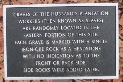
3. Hubbard Family Cemetery Slave Memorial
workers (then known as slaves)
are randomly located in the
eastern portion of this site.
Each grave is marked with a single
iron-ore rock as a headstone
with no indication as to the
front or back side.
Side rocks were added later.
Photographed By Randal B. Gilbert, December 26, 2015
4. Hubbard Family Cemetery Slave Graves
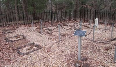
Some of the carefully marked graves of the Hubbard slaves. There are many more in this cemetery.
Both of the brothers-in-law of the elder Hubbard, J.S. Bledsoe and Milton Carter, were Baptist ministers and lived down the road from this location. In about 1854 they founded the Carmel Baptist Church about three miles north. The church allowed slaves to be members and their names are listed in the church minute books. In 1865 Bledsoe purchased land and built the new freedmen their own church, which is named Duck Creek Baptist Church. It still exists as a church.
Both of the brothers-in-law of the elder Hubbard, J.S. Bledsoe and Milton Carter, were Baptist ministers and lived down the road from this location. In about 1854 they founded the Carmel Baptist Church about three miles north. The church allowed slaves to be members and their names are listed in the church minute books. In 1865 Bledsoe purchased land and built the new freedmen their own church, which is named Duck Creek Baptist Church. It still exists as a church.
Credits. This page was last revised on June 20, 2016. It was originally submitted on December 26, 2015, by Randal B. Gilbert of Tyler, Texas. This page has been viewed 1,194 times since then and 103 times this year. Photos: 1, 2, 3, 4, 5. submitted on December 26, 2015, by Randal B. Gilbert of Tyler, Texas. • Bernard Fisher was the editor who published this page.
