Bessemer Bend in Natrona County, Wyoming — The American West (Mountains)
Witnessing the Past
Inscription.
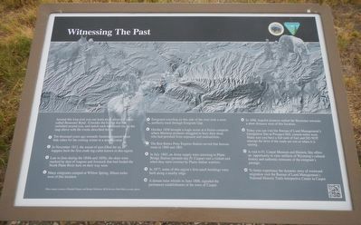
Around this loop trail you can learn more about this place called Bessemer Bend. Consider the history that has unfolded around you, and match each numbered site on the map above with the event described below.
1. Ten thousand years ago nomadic hunters prepared bison hide robes for the coming winter at a nearby camp.
2. In November 1812, the sound of axes filled the air as trappers built the first crude log cabin known in this region.
3. Late in June during the 1840s and 1850s, the skies were marked by dust of wagons and livestock that had forded the North Platte River here on their way west.
4. Many emigrants camped at Willow Springs, fifteen miles west of this location.
5. Emigrants traveling on this side of the river took a more northerly track through Emigrant Gap.
6. October 1856 brought a tragic scene at a frozen campsite where Mormon Pioneers struggled to bury their dead, who had perished from exposure and malnutrition.
7. The Red Butte Pony Express Station served that famous route in 1860 and 1861.
8. In July 1865, an Army supply train returning to Platte Bridge Station (present-day Ft. Caspar) met a violent end when they were overrun by Plains Indian warriors.
9. In 1877, some of this region's first ranch buildings were built along a nearby ridge.
10. A distant train whistle in June 1888, signaled the permanent establishment of the town of Casper.
11. In 1888, hopeful pioneers settled the Bessemer townsite as short distance west of this location.
12. Today you can visit the Bureau of Land Management's Interpretive Site at Prospect Hill, sixteen miles west. Make sure you have a full tank of fuel and DO NOT attempt the drive if roads are wet or when it is raining.
13. A visit to Ft. Caspar Museum and Historic Site offers an opportunity to view artifacts of Wyoming's cultural history and authentic remnants of the emigrant's passage.
14. To better experience the dynamic story of westward migration visit the Bureau of Land Management's National Historic Trails Interpretive Center in Casper.
Erected by Department of the Interior, Bureau of Land Management.
Topics. This historical marker is listed in this topic list: Notable Places.
Location. 42° 46.448′ N, 106° 31.835′ W. Marker is in Bessemer Bend, Wyoming, in Natrona County. Marker is on Bessemer Bend Road (Route 308) near Speas Road (Route 311), on the right when traveling east. Touch for map. Marker is at or near this postal address: 14456 Bessemer Bend Road, Casper WY 82604, United States of America. Touch for directions.
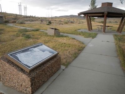
Other nearby markers. At least 8 other markers are within walking distance of this marker. Shape of the Future (here, next to this marker); First Among Many
(within shouting distance of this marker); Marking Their Progress (within shouting distance of this marker); Red Buttes (within shouting distance of this marker); Ranching Takes Its Place (within shouting distance of this marker); Queen City of the West (within shouting distance of this marker); "History Is Not Obvious" (within shouting distance of this marker); Science Visits the West (within shouting distance of this marker). Touch for a list and map of all markers in Bessemer Bend.
More about this marker. This marker is located at the Bureau of Land Management's Bessemer Bend Historic Site.
Credits. This page was last revised on June 16, 2016. It was originally submitted on January 1, 2016, by Barry Swackhamer of Brentwood, California. This page has been viewed 330 times since then and 13 times this year. Photos: 1, 2. submitted on January 1, 2016, by Barry Swackhamer of Brentwood, California.

