Bessemer Bend in Natrona County, Wyoming — The American West (Mountains)
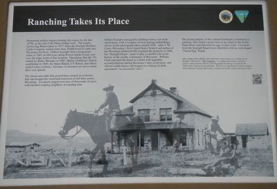
Ranching Takes Its Place
The sheep and cattle that grazed here created an economy that encouraged the westward extension of rail lines across Wyoming. Livestock ranged over tens of thousands of acres, with ranchers helping neighbors at roundup time.
Gilbert Searight managed his holdings from a cut stone ranch house with a complex of rock and log outbuildings, shown in this photograph taken around 1920. After J.M. Caret (Wyoming's first United States Senator and author of the Wyoming statehood bill) acquired the property in 1886, the "Searight House" came to play a colorful role in the history of the nearby community of Bessemer. William Clark operated the house as a hotel with reputable accommodations during the Bessemer's days to promise, and offered saddle horses and buggies to visiting oil field speculator's "at reasonable rates."
The lasting identity of this cultural landmark is attributed to cowboys who found a goose nest on an island in the North Platte River and delivered its eggs to their cook. Livestock from the Searight Ranch were identified with an oval-shaped "Goose Egg" brand.
After author Owen Wister described the ranch house as a setting in his popular 1902 novel "The Virginian," its sudden fame drew curiosity seekers and souvenir hunters who degraded the house so much by the 1950's that it had to be demolished. The Goose Egg Ranch, which predates both Natrona County and Casper, remains an active cattle operation today.
Erected by Department of the Interior, Bureau of Land Management.
Topics. This historical marker is listed in these topic lists: Agriculture • Industry & Commerce. A significant historical year for this entry is 1883.
Location. 42° 46.433′ N, 106° 31.811′ W. Marker is in Bessemer Bend, Wyoming, in Natrona County. Marker is on Bessemer Bend Road (County Route 308) near Speas Road (County Route 311), on the right when traveling east. Touch for map. Marker is at or near this postal address: 14456 Bessemer Bend Road, Casper WY 82604, United States of America. Touch for directions.
Other nearby markers. At least 8 other markers are within walking distance of this marker. Queen City of the West (a few steps from this marker); "History Is Not Obvious"
(within shouting distance of this marker); Shape of the Future (within shouting distance of this marker); Witnessing the Past (within shouting distance of this marker); Science Visits the West (within shouting distance of this marker); Red Buttes (within shouting distance of this marker); Marking Their Progress (within shouting distance of this marker); Reluctant Farewells (within shouting distance of this marker). Touch for a list and map of all markers in Bessemer Bend.
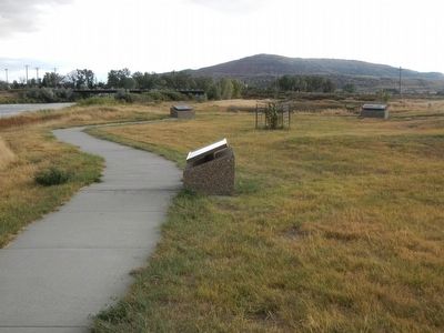
More about this marker. This marker is located at the Bureau of Land Management's Bessemer Bend Historic Site.
Credits. This page was last revised on June 16, 2016. It was originally submitted on January 2, 2016, by Barry Swackhamer of Brentwood, California. This page has been viewed 360 times since then and 16 times this year. Photos: 1, 2. submitted on January 2, 2016, by Barry Swackhamer of Brentwood, California.

