Mills in Natrona County, Wyoming — The American West (Mountains)
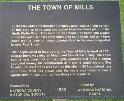
The Town of Mills
The people voted to incorporate the Town of Mills in April of 1921. George Boyle was elected Mayor and took office in May. The Town built a new town hall and a highly controversial bond election approved money for construction of a public water system. The Town’s first water tank was built on this site in 1924 and stood here until 1975. Mills has grown over the years and today is over a square mile in size and has two thousand residents.
Erected 1990 by Natrona County Historical Society.
Topics. This historical marker is listed in this topic list: Settlements & Settlers.
Location. 42° 50.693′ N, 106° 22.509′ W. Marker is in Mills, Wyoming, in Natrona County. Marker is on Platte Avenue near 9th Street, on the left when traveling north. Touch for map. Marker is at or near this postal address: 901 Platte Avenue, Mills WY 82644, United States of America. Touch for directions.
Other nearby markers. At least 8 other markers are within walking distance of this marker. Oregon Trail (here, next to this marker); The “Mormon” Ferry (a few steps from this marker); Guinard Bridge (approx. half a mile away); Site of Old Platte Bridge (approx. half a mile away); The Upper Crossing (approx. half a mile away); The Road to Zion (approx. half a mile away); a different marker also named The Mormon Ferry (approx. half a mile away); Reconstructed Fort Caspar (approx. 0.6 miles away). Touch for a list and map of all markers in Mills.
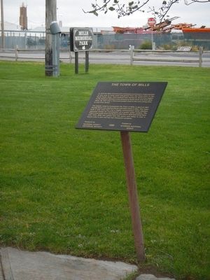
More about this marker. This marker is in City Memorial Park, a triangular park bounded by Platte Avenue, 9th Street and Southwest Wyoming Boulevard in Mills, Wyoming.
Credits. This page was last revised on June 16, 2016. It was originally submitted on January 3, 2016, by Barry Swackhamer of Brentwood, California. This page has been viewed 283 times since then and 8 times this year. Photos: 1, 2. submitted on January 3, 2016, by Barry Swackhamer of Brentwood, California.

