Colonia Tlatelolco in Ciudad de México, Mexico — The Valley of Mexico (The Central Highlands)
Tzompantli altar (“flag of heads”) of the north
Altar Tzompantli (bandera de cabezas) del norte
Inscription.
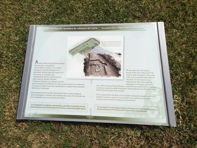
A unos metros de la fachada oriental de este altar, se localizaron acomodados en hileras, 170 cráneos humanos con perforaciones en los parietales (ambos lados del cráneo). Por esta razón, se consideró que originalmente fueron expuestos en la parte superior del altar llamado Tzompantli, (Bandera de Cabezas) nombre para el templo que utilizaban los mexicas para colocar los cráneos de los cautivos de guerra que eran sacrificados en algunos de los templos del Recinto Ceremonial.
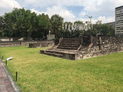
Este tzompantli está orientada al poniente, tiene un solo cuerpo de forma rectangular y presenta una escalinata de acceso. En el lado sur hay un grabado en la roca con forma de mano.
Los Tzompantli son evidencias arqueológicas que ahora nos pueden parecer estremecedoras, pero forman parta (sic parte) de la historia y cultura del pueblo mexica.
Pie de dibujo:
Las excavaciones arqueológicas realizadas en este lugar permitieron corroborar las fuentes escritas por los españoles en el siglo XVI respecto al uso del Tzompantli y sus características, pues se encontraron 170 cráneos con perforaciones en los parietales.
A few yards from the Eastern facade of this altar, they found 170 human skulls arranged in rows, with holes on the parietals (both sides of the skull). For this reason, it was believe that they were originally displayed on the upper part of the altar called Tzompantli (flag of heads), a name for the temple that the mexicas would use to place the skulls of prisoners of war that were sacrificed in some of the Ceremonial Sanctuary temples.
This tzompantli faces the West. It has a single rectangular-shaped body and exhibits an entrance staircase. On the altar on the southern end, there is a carving in the rock with the shape of a human hand.
The Tzompantli is archeological evidence that may now seem shocking to us, but they form part of the history and culture of the mexica people.
English translation of the caption:
Archaeological excavations done here corroborated written 16th century accounts from the Spanish about the use of the tzompantli with the finding of 170 skulls here that were perforated through the parietals.
Topics. This historical marker is listed in these topic lists: Anthropology & Archaeology • Man-Made Features.
Location. 19° 27.098′ N, 99° 8.216′ W. Marker is in Ciudad de México. It is
in Colonia Tlatelolco. The marker is at the Tlatelolco Archeological Site on Eje Central near the intersection with Avenida Ricardo Flores Magón. Touch for map. Marker is in this post office area: Ciudad de México 06900, Mexico. Touch for directions.
Other nearby markers. At least 8 other markers are within walking distance of this marker. Momoztli: a neighborhood altar (a few steps from this marker); Battle of Tlatelolco (within shouting distance of this marker); Favor request…and talent for the gods (within shouting distance of this marker); Walls and roads: limits and communication (within shouting distance of this marker); 50th Anniversary of the Treaty of Tlatelolco (within shouting distance of this marker); Coyolxauhqui: The dismembered goddess (within shouting distance of this marker); The Reign of Cuauhtemoctzin (within shouting distance of this marker); Tlatelolco Massacre of October 2, 1968 (within shouting distance of this marker). Touch for a list and map of all markers in Ciudad de México.

Photographed By J. Makali Bruton, November 2, 2015
3. Tlatelolco: present, past and future
This additional educational marker is a few steps along the walkway and reads: Tlatelolco: presente, pasado y future
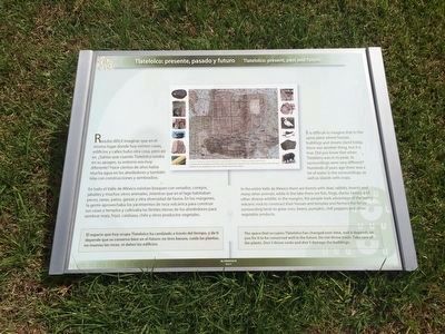
Resulta difícil imaginar que en el mismo lugar donde hoy existen casas, edificios y calles hubo otra cosa, pero así es. ¿Sabías que cuando Tlatelolco estaba en su apogeo, su entorno era muy diferente? Hace cientos de años había mucha agua en los alrededores y también islas con construcciones y sembradíos.
En todo el valle de México existían bosques con venados, conejos, jabalíes y muchos otros animales, mientras que en el lago habitaban peces, ranas, patos, garzas y otra diversidad de fauna. En los márgenes, la gente aprovechaba los yacimientos de roca volcánica para construir sus casas y templos y cultivaba las fértiles tierras de los alrededores para sembrar maíz, frijol, calabaza, chile y otros productos vegetales.
El espacio que hoy ocupa Tlatelolco ha cambiado a través del tiempo, y de ti depende que se conserve bien en el futuro: no tires basura, cuida las plantas, no muevas las rocas, ni dañes los edificios.
Pie de dibujo:
Fragmento del Mapa de Uppsala (elaborado en el siglo XVI) dónde se puede ver Tlatelolco y el antiguo lago de Texcoco.
La ubicación de Tlatelolco permitió que sus habitantes tuvieran acceso a diversos recursos naturales que existían en los alrededores, así como a fértiles tierras de cultivo.
English:
It is difficult to imagine that in the same place where houses, buildings and streets stand today, there was another thing, but it is true. Did you know that when Tlatelolco was in its peak, its surroundings were very different? Hundreds of years ago there was a lot of water in the surroundings, as well as islands with crops.
In the entire Valle de México there are forests with dear, rabbits, boards and many other animals, while in the lake there are fish, frogs, ducks, herons and other diverse wildlife. In the margins, the people took advantage of the laying volcanic rock to construct their houses and temples and farmed the fertile surrounding lands to grow corn, beans, pumpkin, chili peppers and other vegetable products.
The space that occupies Tlatelolco has changed over time, and it depends on you for it to be conserved well in the future: Do not throw trash. Take care of the plants. Don´t throw rocks and don´t damage the buildings.
English translation of caption:
Fragment of the Uppsala Map (made in the 16th century) where Tlatelolco and the lake of Texcoco can be seen.
Tlatelolco´s location permitted its inhabitants access to diverse natural resources that existed nearby, such as fertile lands to cultivate.
Credits. This page was last revised on April 17, 2020. It was originally submitted on January 4, 2016, by J. Makali Bruton of Accra, Ghana. This page has been viewed 396 times since then and 8 times this year. Photos: 1, 2, 3. submitted on January 4, 2016, by J. Makali Bruton of Accra, Ghana.

