Near Glenrock in Converse County, Wyoming — The American West (Mountains)
Big Muddy Oil Field
Inscription.
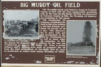
Big Muddy oil field is a typical Wyoming oil producing structure. The field, discovered in 1916, has produced over 30 million barrels of high quality oil. Strata here were arched upward at the time the Rocky Mountains originated about 60 million years ago, to form an anticline, or dome. Because oil is lighter than water, it rose to the crest of the dome where it was trapped in pore spaces between sand grains. The Wall Creek sand lies at a depth of near 3,000 feet and the Dakota sand at about 4,000 feet.
The first oil well in Wyoming was drilled in 1884. There are now about 100 oil fields in the state.
Erected by Wyoming State Parks & Cultural Resources.
Topics. This historical marker is listed in this topic list: Natural Resources. A significant historical year for this entry is 1916.
Location. 42° 50.194′ N, 105° 59.83′ W. Marker is near Glenrock, Wyoming, in Converse County. Marker is on Interstate 25 at milepost 170 near County Road 11 (underpass), on the right when traveling west. Touch for map. Marker is in this post office area: Glenrock WY 82637, United States of America. Touch for directions.
Other nearby markers. At least 5 other markers are within 7 miles of this marker, measured as the crow flies. Ada Magill (approx. 1.3 miles away); Site of Brigham Young (BYX) Mail Station (approx. 4.8 miles away); Rock in the Glen (approx. 6 miles away); Ferdinand V. Hayden (approx. 6˝ miles away); Deer Creek Station (approx. 6.6 miles away).
Also see . . . Five Wyoming Oil Fields and the Transformation of an Economy -- WyoHistory. ...story is contained in the history of five of the state’s major oil fields—the Lance Creek, Elk Basin, Oregon Basin, Grass Creek and Big Muddy fields. The Lance Creek Field in Niobrara County was the most productive of the five by the end of 1956, followed by the Elk Basin and Oregon Basin fields in Park County; Grass Creek in Hot Springs County; and the Big Muddy Field in Converse County. All were early large producers, sparking the development of roads, pipelines and refineries as the market for oil grew. (Submitted on January 7, 2016, by Barry Swackhamer of Brentwood, California.)
Credits. This page was last revised on June 16, 2016. It was originally submitted on January 7, 2016, by Barry Swackhamer of Brentwood, California. This page has been viewed 589 times since then and 29 times this year. Photos: 1, 2. submitted on January 7, 2016, by Barry Swackhamer of Brentwood, California.

