El Asintal, Retalhuleu, Guatemala — Central America
Piecitos Station
Altar 46 - "Piecitos"
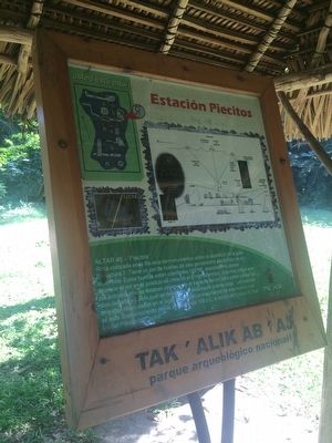
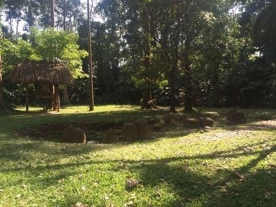
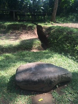
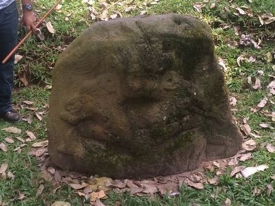
Roca colocada en la fila este de monumentos sobre la superficie de la gran Estructura 7. Tiene un par de huellas de pies genialmente esculpidos en su superficie. Estas huellas estan orientadas 115°NE, exactamente donde aparece el sol en el solsticio de invierno el 21 de diciembre. Esto nos indica que los antiguos mayas estaban observando el trayecto del sol para poder contar los dias del año y con lo cual de desarolla el sistema de cuenta larga. Las masivas ofrendas depositadas en el lugar testigua la importancia de este evento que se esta conmemorando desde alrededor de 100 d.C. a inicios de b'aqtun 8, finales del Preclasico Tardío.
Mapa de los monumentos encima de la estructura 7 y indicaciones sobre dónde pasan los solticios del año
Alta 46 - "Piecitos" ("Little Feet")
This rock in this line of monuments here on top of Structure 7 has a pair of footprints deftly carved into its surface. These prints are oriented to 115° NE, exactly in the direction where the sun appears on the winter solstice of December 21. This indicates to us that the ancient Maya were observing the sun's trajectory in order to count the days of the year, and with that, developing their Long Count calendar. The massive offerings in the form of stone monuments deposited in this place testify to the importance of this event that has been commemorated since around 100 CE at the beginning of b'aqtun 8 at the end of the Late Preclassic.
Map of the monuments on top of Structure 7 and indications of where the solstice occurs during the year.
Topics. This historical marker is listed in these topic lists: Anthropology & Archaeology • Man-Made Features • Native Americans. A significant day of the year for for this entry is December 21.
Location. 14° 38.275′ N, 91° 43.9′ W. Marker is in El Asintal, Retalhuleu. Km. 199, Tak'alik Ab'aj Archaeological Park, Reserva Natural Privada Santa Margarita, Municipio El Asintal. Touch for map. Marker is in this post office area: El Asintal, Retalhuleu 11009, Guatemala. Touch for directions.
Other nearby markers. At least 7 other markers are within 32 kilometers of this marker, measured as the crow flies. Guacalitos Station (about 90 meters away, measured in a direct line); Tanmi Tnam Plaza (about 120 meters away); Stela 18 Station (about 150 meters away); Sweat Lodge (approx. 0.3 kilometers away); Plaza Tukur Balam (approx. 0.3 kilometers away); Structure 11
(approx. 0.3 kilometers away); The Soldiers Monument of Quetzaltenango (approx. 31.1 kilometers away in Quetzaltenango).
Regarding Piecitos Station. Tak'alik Ab'aj is the oldest known Mayan site, dating from 900 BCE, and was continuously inhabited until ca. 1000. The site is unique in that it has many examples of Olmec influence on early Mayan culture.
A b'aqtun is a period of time equal to about 394 years. The period of the 8th and 9th b'aqtuns correspond to the period of the highest development in ancient Mayan society.
The Long Count calendar identifies a date by counting the number of days from a "creation date" that normally is calculated to be September 6, 3114 BCE.
Credits. This page was last revised on March 2, 2018. It was originally submitted on January 11, 2016, by J. Makali Bruton of Accra, Ghana. This page has been viewed 266 times since then. Photos: 1, 2, 3, 4. submitted on January 11, 2016, by J. Makali Bruton of Accra, Ghana.


