Near Cheyenne in Laramie County, Wyoming — The American West (Mountains)
Yellowstone Highway
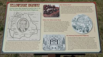
Grows into the longest road in the U.S., The National Park-to-Park Highway

Photographed By Barry Swackhamer, September 19, 2015
1. Yellowstone Highway Marker
Captions: (left) Stephen Mather and map of his envisioned Park-to-Park Highway.; (top center) First automobiles to enter Yellowstone National Park; "Getting Together in the Right Way."; (bottom center) National Park-to-Park Highway Logo.
"See America First"
Yellowstone was established in 1872 as the first national park. By 1919, eleven other western national parks had joined its ranks. Since rich Americans traditionally vacationed in Europe, several western destinations and railways began promoting travel to the wonders of the West with the slogan, "See America First" -- especially during World War I. By the 1920s, as the growing middle class had more time, money, transportation (thanks to Henry Ford), and destinations provided by the national parks, the American road trip was born.
Follow the Yellow-stone Road
Yellowstone Park gave access to automobiles in 1915, the same year Rocky Mountain National Park near Denver was established. The two events lead to the development of Yellowstone Highway, which connected the parks and their state capitals, and was called "the leading road in the State of Wyoming." Stephen Mather -- who was the energy behind many of the national parks being created and behind the establishment of the National Park Service -- enthusiastically endorsed extending Yellowstone Highway to connect all the western national parks.
The National Park-to-Park Highway
The 600-mile Yellowstone Highway extended into the almost 6,000-mile National Park-to-Park Highway thanks to park promoters and the Good Roads Movement, which was initiated by bicyclists in 1880 and adopted by motorists to advocated quality rural roads. Completed in 1920 at almost twice the length of the transcontinental Lincoln Highway, the National Park-to-Park Highway was the longest automobile project to date. A 20-car caravan made the landmark journey along it in a 76-day dedication tour. Though mostly unpaved when completed, the road was described as "the master motor road of the country."
Topics. This historical marker is listed in this topic list: Roads & Vehicles.
Location. 41° 3.517′ N, 104° 52.757′ W. Marker is near Cheyenne, Wyoming, in Laramie County. Marker can be reached from High Plains Road near Interstate 25, on the left when traveling east. Touch for map. Marker is at or near this postal address: 5611 High Plains Road, Cheyenne WY 82007, United States of America. Touch for directions.
Other nearby markers. At least 8 other markers are within 6 miles of this marker, measured as the crow flies. Wyoming’s Wildlife Heritage (within shouting distance of this marker); Magic City of the Plains (within shouting distance of this marker); Outlaws! (within shouting distance of this marker); Trails & Tales of I-25 (within shouting distance of this marker); The Greeting and The Gift (about 500 feet away, measured in a direct line); Cheyenne Corner Stone (approx. 4.8 miles away); Camp Carlin (approx. 5.6 miles away); Cheyenne's Early Fire Companies (approx. 5.9 miles away). Touch for a list and map of all markers in Cheyenne.
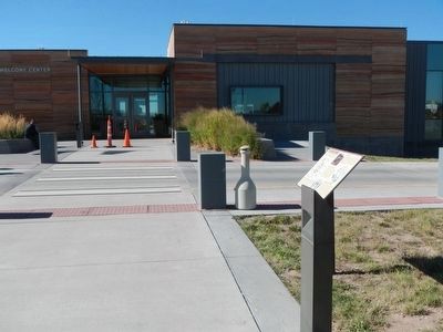
More about this marker. This marker is at the Wyoming Travel and Tourism Welcome Center located east of Interstate 25 at Exit 4.
Credits. This page was last revised on June 16, 2016. It was originally submitted on January 13, 2016, by Barry Swackhamer of Brentwood, California. This page has been viewed 631 times since then and 59 times this year. Photos: 1, 2. submitted on January 13, 2016, by Barry Swackhamer of Brentwood, California.
