Near Cheyenne in Laramie County, Wyoming — The American West (Mountains)
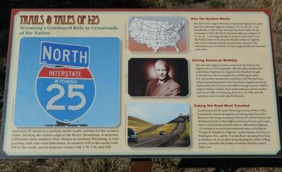
Trails & Tales of I-25
Wyoming's Continued Role as Crossroads of the Nation
How the System Works
You don't need a map to determine an interstate highway's location and route. Interstate highways ending in "0" (10, 20, 30, ...) run latitudinally, or west to east, starting in the South with I-10 and increasing to I-90 in the North. Interstate highways ending in "5" (5, 15, 25, ...) run longitudinally, or south to north, from I-5 on the Pacific Coast to I-95 along the Atlantic Seaboard. Together they weave a national network of expressways. Based on this information, you can tell that I-25 runs longitudinally and is located in the West.
Driving American Mobility
Out interstate highway system results from the Federal-Aid Highway Act of 1956, popularly called the National Interstate and Defense Highway Act. Supported by President Dwight D. Eisenhower, the act emerged due to lobbying by major U.S. automobile manufacturers and from Cold War fears that, without ground transport routes for military supplies ands troop deployments, the U.S. was vulnerable to foreign invasion. Built to support military vehicles, these roads stand up to harsh weather and lots of traffic. In Wyoming, however, I-25, I-80, and I-90 sometimes close in winter due to blizzards.
Taking the Road Most Traveled
Construction of I-25 across Wyoming ran from 1956 to 1982. It seamlessly connected segments of existing roads from New Mexico to Wyoming, including US Route 87, which had been the old National Park-to-Park Highway between Denver and Casper, which in turn had absorbed the historic Yellowstone Highway. I-25 belongs to several transcontinental routes, including the "Dwight D. Eisenhower Highway" connecting San Francisco to Washington, D.C., and the "Camino Real" spanning from Texas to Montana. So, as you drive along enjoying the endless rolling prairie, remember the century of vehicles that have passed before you.
Topics and series. This historical marker is listed in this topic list: Roads & Vehicles. In addition, it is included in the Former U.S. Presidents: #34 Dwight D. Eisenhower series list.
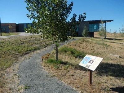
Location. 41° 3.546′ N, 104° 52.773′ W. Marker is near Cheyenne, Wyoming, in Laramie County. Marker can be reached from High Plains Road near Interstate 25, on the left when traveling east. Touch for map. Marker is at or near this postal address: 5611 High Plains Road, Cheyenne WY 82007, United States of America. Touch for directions.
Other nearby markers. At least 8 other markers are within 6 miles of this marker, measured as the crow flies. Yellowstone Highway (within shouting distance of this marker); Outlaws! (within shouting distance of this marker); Wyoming’s Wildlife Heritage (about 300 feet away, measured in a direct line); Magic City of the Plains (about 300 feet away); The Greeting and The Gift (about 500 feet away); Cheyenne Corner Stone (approx. 4.8 miles away); Camp Carlin (approx. 5.6 miles away); Cheyenne's Early Fire Companies (approx. 5.9 miles away). Touch for a list and map of all markers in Cheyenne.
More about this marker. This marker is at the Wyoming Travel and Tourism Welcome Center located east of Interstate 25 at Exit 4.
Credits. This page was last revised on January 24, 2024. It was originally submitted on January 13, 2016, by Barry Swackhamer of Brentwood, California. This page has been viewed 678 times since then and 76 times this year. Last updated on January 21, 2024, by Carl Gordon Moore Jr. of North East, Maryland. Photos: 1, 2. submitted on January 13, 2016, by Barry Swackhamer of Brentwood, California. • J. Makali Bruton was the editor who published this page.

