Superior in Sweetwater County, Wyoming — The American West (Mountains)
Town Development
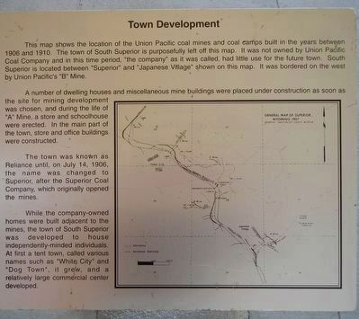
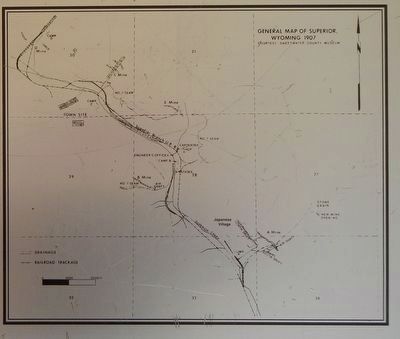
A number of dwelling houses and miscellaneous mine buildings were placed under construction as soon as the site for mining development was chosen, and during the life of ”A” Mine, a store and schoolhouse were erected. In the main part of the town, store and office buildings were constructed.
The town was known as Reliance until, on July 14, 1906, the name was changed to Superior, after the Superior Coal Company which originally opened the mines.
While the company-owned homes were built adjacent to the mines, the town of South Superior was developed to house independently-minded individuals. At first a tent town, called various names such as “White City” and “Dog Town”, it grew, and a relatively large commercial center developed.
Erected by The People of the Town of South Superior, The Wyoming Department of Environment, Tern Engineering, Western Wyoming Community College, Noel Griffith & Associates, Sweetwater County Commissioners, Linda Tallifero, Larry Calier and Fred Radosovich.
Topics. This historical marker is listed in this topic list: Settlements & Settlers.
Location. 41° 45.737′ N, 108° 58.084′ W. Marker is in Superior, Wyoming, in Sweetwater County. Marker is on Main Street (State Highway 371) near Berta Street, on the left when traveling north. Touch for map. Marker is at or near this postal address: 109 Main Street, Superior WY 82945, United States of America. Touch for directions.
Other nearby markers. At least 8 other markers are within 11 miles of this marker, measured as the crow flies. Working in the Mines (here, next to this marker); Opening the Mines (here, next to this marker); Immigrants (here, next to this marker); Unions (here, next to this marker); Prospecting (a few steps from this marker); Superior (a few steps from this marker); Point of Rocks (approx. 10.7 miles away); An Unsolved Mystery (approx. 10.8 miles away). Touch for a list and map of all markers in Superior.
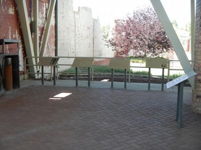
More about this marker. This marker is located at the Miners Union Hall.
Credits. This page was last revised on June 16, 2016. It was originally submitted on January 14, 2016, by Barry Swackhamer of Brentwood, California. This page has been viewed 461 times since then and 11 times this year. Photos: 1, 2, 3. submitted on January 14, 2016, by Barry Swackhamer of Brentwood, California.


