Near Henrico in Henrico County, Virginia — The American South (Mid-Atlantic)
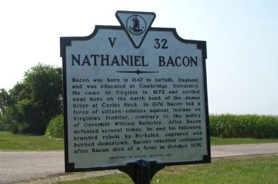
Nathaniel Bacon
Erected 1996 by Department of Historic Resources. (Marker Number V-32.)
Topics and series. This historical marker is listed in these topic lists: Colonial Era • Settlements & Settlers. In addition, it is included in the Virginia Department of Historic Resources (DHR) series list. A significant historical month for this entry is October 1676.
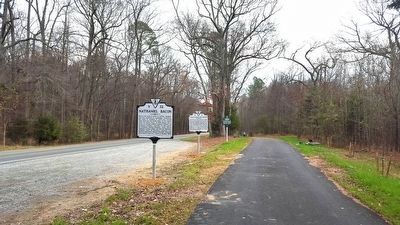
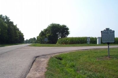
Location. 37° 24.445′ N, 77° 16.656′ W. Marker is near Henrico, Virginia, in Henrico County. Marker is on New Market Road (Virginia Route 5) 0.6 miles east of Curles Neck Road, on the right when traveling east. Touch for map. Marker is in this post office area: Henrico VA 23231, United States of America. Touch for directions.
Other nearby markers. At least 8 other markers are within 2 miles of this marker, measured as the crow flies. Curles Neck and Bremo (within shouting distance of this marker); Captain Thomas Harris (within shouting distance of this marker); James Crewes (approx. half a mile away); Turkey Island Mansion (approx. half a mile away); Engagement at Malvern Cliffs (approx. half a mile away); The Flood of 1771 (approx. half a mile away); Turkey Island (approx. half a mile away); First Battle of Deep Bottom (approx. 1.2 miles away). Touch for a list and map of all markers in Henrico.
More about this marker. This marker, originally located at the entrance to Curles Neck Farm, has been moved 0.6 miles east.
Credits. This page was last revised on July 7, 2021. It was originally submitted on July 17, 2008, by Kathy Walker of Stafford, Virginia. This page has been viewed 1,912 times since then and 49 times this year. Photos: 1. submitted on July 17, 2008, by Kathy Walker of Stafford, Virginia. 2. submitted on December 14, 2015, by Bernard Fisher of Richmond, Virginia. 3. submitted on July 17, 2008, by Kathy Walker of Stafford, Virginia. • Christopher Busta-Peck was the editor who published this page.


