Antigua Guatemala, Sacatepéquez, Guatemala — Central America (Central Highlands)
Volcano Agua
Volcán de Agua
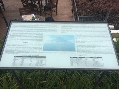
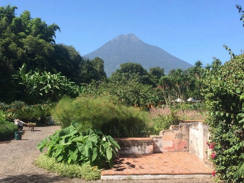
El nombre se origina a raíz de la destrucción de la ciudad de Santiago de los Caballeros en su segundo asiento oficial, en septiembre de 1541, cuando quedó soterrada por un gran torrente de agua y piedra que brotó del seno del volcán. Esta inundación se debió a la ruptura de un dique natural causada por fuertes sismos que provocaron la correntada del agua estancada en las laderas. Este volcán es el que tiene el mayor volumen en Guatemala, con un diámetro en su base de aproximadamente 15 kilómetros, a 3,765 metros sobre el nivel del mar.
Su forma es casi cónica; a excepción de una irregularidad a las tres cuartas partes de su altura que se puede observar al oeste y sur de la circunferencia y que se explica como una especie de atrio, es decir, originalmente el cráter había sido a esta altura, pero erupciones posteriores formaron un nuevo cono, el cual rellenó el antiguo en su totalidad, de manera que solo quedó una prominencia ligera en forma de medio anillo. El cráter actual, al cual se puede llegar a caballo, es elíptico. El fondo quedó a unos 130 metros debajo del punto más alto (O y SO) de la circunvalación.
El volcán está cubierto casi hasta su cúspide por vegetación, aun cuando en la parte superior es escasa. Al evaluar las fotografías verticales tomadas encima del cráter, se pueden reconocer tres costillas paralelas que del borde nor-oeste se dirigen falda abajo en ese rumbo. Entre ellas existen dos canales paralelos, causando la impresión de haber sido originados por taludes que rebalsaron del cráter, indicando un deslizamiento forzado y súbito de masas provenientes del interior, no quedando duda que el borde del mismo debe haber estado un poco más alto que el actual.
Al pie del volcán hay un pocito de aguas termales muy calientes, llamado San Andrés por estar cerca de un pueblo con este nombre, en el que se curan diversas enfermedades; y otro de agua templada, que despide olor azufroso y es remedio eficaz para la sarna.
Terremotos
El territorio guatemalteco está repartido en tres placas tectónicas: Norteamérica, Caribe y Cocos. Los movimientos relativos entre ésta determinan los principales rasgos topográficos del país y la distribución de los terremotos y volcanes.
El contacto entre las placas Norteamérica y Caribe es de tipo transcurrente. Su manifestación en la superficie son las fallas de Chixoy, Polochic y Motagua. El contacto entre las placas de Cocos y del Caribe es de tipo convergente, en el que la primera se mete debajo de la segunda (fenómeno conocido como
subducción). Este proceso da origen a una gran cantidad de temblores y formación de volcanes. El contacto entre estas dos placas está aproximadamente a 50 kilómetros frente a las costas del Océano Pacifico. A su vez, estos dos procesos generan deformaciones al interior de a Placa del Caribe, produciendo fallamientos secundarios como: Jalpatagua, Mixco, Santa Catarina Pinula, etc.
Tabla de Terremotos del Siglo XX en Guatemala
The name Agua originated from the destruction of Guatemala’s capital, on its second official site, in September 1541, when the volcano burst and a great torrent of water and stones flowed from the volcano and buried Ciudad Vieja. This flood was caused by the fracture of a natural dike, caused by earthquakes. The water that was dammed up on the slopes descended and flooded the city. This volcano is the one with largest volume in Guatemala, with a diameter at the base of approximately 15 kilometers, and is located 3,765.96 meters over sea level.
Its shape is almost perfectly conical. About three quarters of the way up there is an irregularity that can be seen to the west and south of the circumference and is explained as a sort of atrium. This means that before, the crater to be there, but later eruptions formed a new cone that completely filled the old crater in such a way that only a slight semi-circular
protuberance remained. The present crater, which can be reached on horseback, is elliptical. The bottom is about 130 meters under the highest point (W and SW) of the circle.
The volcano is covered with vegetation almost to the top, even though it is scarce on the highest part. When evaluating the vertical photographs taken over the crater, three parallel ribs can be recognized going downwards from the northwestern border. Between them there are two parallel channels, giving the impression that they originated from slopes that slid from the crater, unequivocally indicating a sudden forced slide of masses emerging from the interior. This leads to the conclusion that the border must have been a bit higher than it is now.
At the foot of the volcano there is a small well of very-hot thermal waters, where various illnesses are cured, called of San Andrés because of its proximity to a town by that name and another moderately warm fountain with a distinct sulfuric smell, whose waters are an effective cure for scabies.
Earthquakes
The national territory is sitting on three tectonic plates: North America, Caribbean and Cocos. The relative movements between them determine the country’s topographic characteristics and the distribution of earthquakes and volcanoes.
Contact between the North American and the Caribbean plates, is of the trans-current type. Surface manifestations are the Chixoy, Polochic and Motagua faults. Contact between the Cocos Plate and the Caribbean Plate is of the convergent type, where the Cocos Plate goes under the Caribbean Plate. This process causes a great number of tremors and formation of new volcanoes. The contact between these two plates is approximately 50 kilometers in front of the Pacific Coast. At the same time, these two processes generate deformations inside the Caribbean Plate, producing secondary faults such as: Jalpatagua, Mixco, Santa Catarina Pinula, etc.
Table of 20th Century Earthquakes in Guatemala
Topics. This historical marker is listed in these topic lists: Colonial Era • Disasters. A significant historical year for this entry is 1541.
Location. 14° 33.154′ N, 90° 43.374′ W. Marker is in Antigua Guatemala, Sacatepéquez. The marker is in the outdoor seating area for the El Tenedor restaurant on Cerro Santo Domingo. The Cerro Santo Domingo is reached from an unnamed cobblestone street on the right after the Shell Gas Station when leaving Antigua Guatemala on Calle de Chipilapa towards Guatemala City. Touch for map. Marker is in this post office area: Antigua Guatemala, Sacatepéquez 03001, Guatemala. Touch for directions.
Other nearby markers. At least 8 other markers are within walking distance of this marker. Volcanos Fuego and Acatenango (here, next to this marker); Catholic Church of Santa Ana (approx. 0.6 kilometers away); Home of Brother Pedro (approx. 0.6 kilometers away); Pedro Cofiño and Ramon Palencia Shot by Firing Squad (approx. 0.7 kilometers away); Las Delicias Fountain (approx. 0.7 kilometers away); Friar Augusto Ramírez Monasterio (approx. 0.8 kilometers away); Don Rafael V. Alvarez Polanco (approx. 0.8 kilometers away); J. Adrian Coronado y Polanco (approx. 0.8 kilometers away). Touch for a list and map of all markers in Antigua Guatemala.
Credits. This page was last revised on March 2, 2018. It was originally submitted on February 10, 2016, by J. Makali Bruton of Accra, Ghana. This page has been viewed 657 times since then and 32 times this year. Photos: 1, 2. submitted on February 10, 2016, by J. Makali Bruton of Accra, Ghana. 3. submitted on July 15, 2016, by J. Makali Bruton of Accra, Ghana.


