Civic Center in Manhattan in New York County, New York — The American Northeast (Mid-Atlantic)
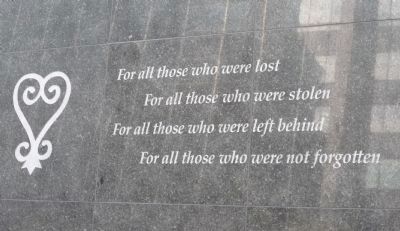
"Sankofa"
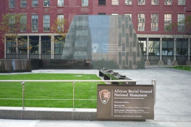
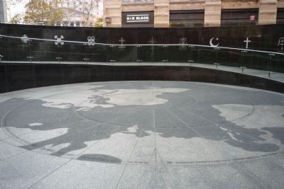
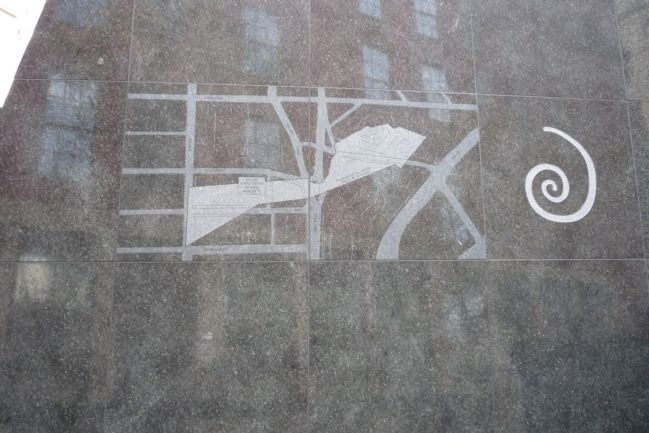
African Burial Ground National Monument
For all those who were lost,
For all those who were stolen,
For all those who were left behind,
For all those who were not forgotten.
Erected 2007 by National Park Service, U.S. Department of the Interior.
Topics and series. This historical marker is listed in these topic lists: African Americans • Cemeteries & Burial Sites • Colonial Era • Native Americans. In addition, it is included in the National Historic Landmarks series list.
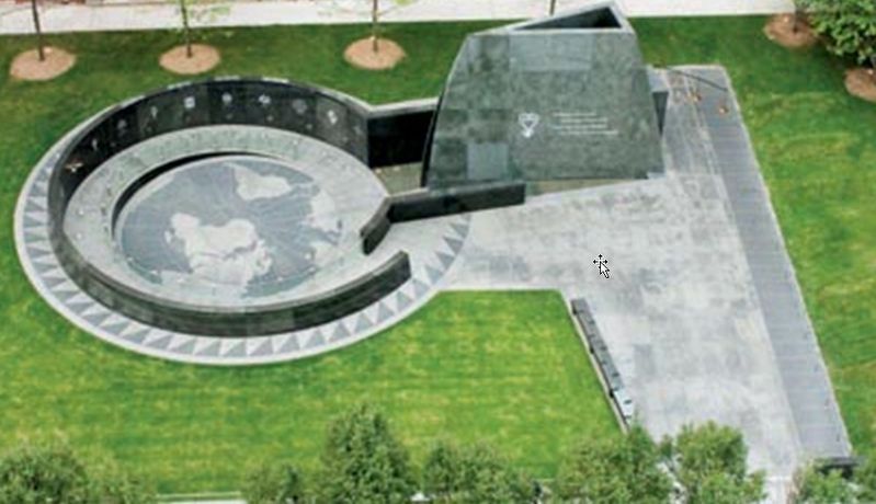
Location. 40° 42.864′ N, 74° 0.267′ W. Marker is in Manhattan, New York, in New York County. It is in Civic Center. Marker is on Federal Plaza/Duane Street, 0 miles west of African Burial Ground Way/Elk Street, on the right when traveling east. Marker inscriptions are part of the African Burial Ground Memorial designed by Rodney Leon and are accessible to pedestrians on the eastern grounds of the Ted Weiss Federal Building (290 Broadway) off Federal Plaza/Duane Street. Touch for map. Marker is at or near this postal address: 290 Broadway, New York NY 10007, United States of America. Touch for directions.
Other nearby markers. At least 8 other markers are within walking distance of this marker. Changing Landscape Obscures the Past (a few steps from this marker); African Burial Ground National Monument (a few steps from this marker); Africans in Early New York (within shouting distance of this marker); Sacred Tradition, Sacred Ground (within shouting distance of this marker); African Burial Ground (within shouting distance of this marker); Foley Square c. 1730 (about 300 feet away, measured in a direct line); Judge Walter R. Mansfield Memorial (about 300 feet away); Surrogates Court (about 300 feet away). Touch for a list and map of all markers in Manhattan.
Regarding "Sankofa". The monument is listed in the "AIA (American Institute of Architects) Guide to New York City, Fifth Edition".
Also see . . .
1. Sankofa. (Submitted on November 5, 2008, by Richard E. Miller of Oxon Hill, Maryland.)
2. African Burial Ground National Monument. (Submitted on November 5, 2008, by Richard E. Miller of Oxon Hill, Maryland.)
3. Middle Passage Ceremonies and Port Markers Project (MPCPMP). The Middle Passage Ceremonies and Port Markers Project (MPCPMP) is a non-profit tax-exempt organization established in 2011 to honor the two million captive Africans who perished during the transatlantic crossing known as the Middle Passage and the ten million who survived to build the Americas. (Submitted on May 1, 2020, by John Bloomfield of Palm Coast, Florida.)
Additional commentary.
1. Middle Passage Ceremonies and Port Markers Project Narrative: UNESCO Site of Memory
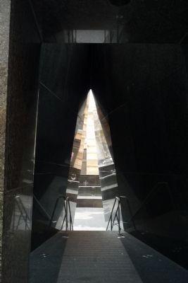
In 2006, President George W. Bush proclaimed the African Burial Ground a National Monument administered and managed by the National Park Service. In 2007, a 25-foot (7.62 meters) granite exterior memorial designed by Rodney Leon was installed with six pieces of art inside the Ted Weiss federal building to commemorate and educate visitors about the site, its history, and the enslaved and free Africans in old New York.
Manhattan, New York, was initially Dutch-controlled and later became a major British colonial city. It was primarily a commercial and financial center for shipping throughout the Americas and Europe. In the 18th century, New York had the second highest urban concentration of enslaved Africans on the North American main-land. From 1655 until 1775, 63 ships delivered approximately 5,600 captives directly from Africa to the city.
In 1991, the remains of 400 Africans were uncovered during excavation for the federal Foley Square Courthouse in Lower Manhattan; they were part of the largest colonial cemetery for Africans in North America (15,000-20,000). From the late 1600s until 1794, the cemetery was a place of internment as well as a center for community and spiritual life. Known as the African Burial Ground, encompassing approximately 5 city blocks or 6 acres located north of Wall Street in lower Manhattan, the area created a segregated location for the burial of Africans and people of African descent outside of the city limits. Currently, the National Park Service operates an interpretive center which serves as the city of New York’s Middle Passage site at the courthouse location. It is a U.S. National Historic Landmark, a National Monument, and a “Site of Memory” associated with the UNESCO Slave Trade Route Project.
Source - For additional information: GSA Introduction to African Burial Ground Final Reports: https://www.gas. gov/portal/content/249941The New York African Burial Ground: Unearthing the African Presence in Colonial New York, 2009, also known as The New York African Burial Ground General Audience Report https://www.gsa. gov/portal/getMediaData?mediald=172603
— Submitted May 1, 2020, by John Bloomfield of Palm Coast, Florida.
Additional keywords. Slavery, Negroes, Akan, Congo, New Amsterdam,
Rodney Leon.
Credits. This page was last revised on January 31, 2023. It was originally submitted on November 5, 2008, by Richard E. Miller of Oxon Hill, Maryland. This page has been viewed 2,644 times since then and 19 times this year. Last updated on February 15, 2019, by Larry Gertner of New York, New York. Photos: 1, 2. submitted on November 5, 2008, by Richard E. Miller of Oxon Hill, Maryland. 3. submitted on May 1, 2020, by John Bloomfield of Palm Coast, Florida. 4, 5, 6. submitted on November 5, 2008, by Richard E. Miller of Oxon Hill, Maryland. • Bill Pfingsten was the editor who published this page.
