Near San Andrés in San Juan Opico, La Libertad, El Salvador — Central America (West Coast)
Indigo Production at San Andrés
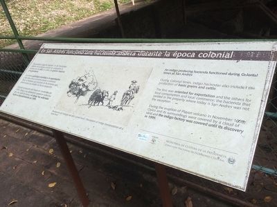
En San Andrés funcionó una hacienda añilera durante la época colonial
De acuerdo a algunas fuentes, en las haciendas añileras de la época colonial se conjugaba la producción de añil, el cultivo de granos básicos y la ganadería.
La primera actividad orientada a la exportación y las otras dos al consumo propio y comercio local, la hacienda que funcionó en los terrenos que ahora ocupa San Andrés no fue la excepción.
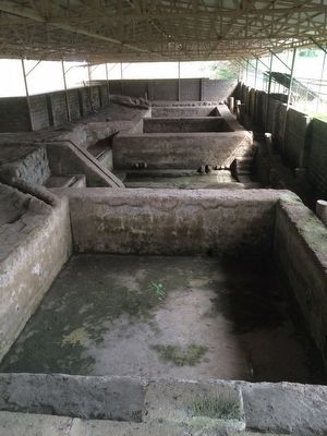
Durante la erupción del Playón en noviembre de 1658, Opico y sus alrededores quedaron cubiertos por una numbe de arena y el obraje fue soterrado hasta su descubrimiento en 1995.
Pie de dibujo: Recreación del traslado de añil a nivel local.
An indigo producing hacienda functioned during Colonial times at San Andrés
During Colonial times, indigo haciendas also included the production of basic grains and cattle.
The first was oriented for exportation and the others for local consumption and local commerce, the hacienda that existed in the property where today is San Andres was not the exception.
During the eruption of Playon volcano in November 1658, Opico and its surroundings were covered by a cloud of sand and the indigo factory was covered until its discovery in 1995.
Caption: Recreation of indigo transportation at a local level.
Erected by Secretaría de Cultura de la Presidencia de El Salvador.
Topics. This historical marker is listed in these topic lists: Anthropology & Archaeology • Man-Made Features. A significant historical month for this entry is November 1658.
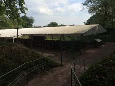
Location. 13° 47.926′ N, 89° 23.232′ W. Marker is near San Andrés, La Libertad, in San Juan Opico. Marker can be reached from Kilómetro 32 Carretera Panamericana. The marker is on the grounds of the San Andrés Archaeological Site, to the east of the Acrópolis on a separate walkway to the old indigo factory. Touch for map. Marker is in this post office area: San Andrés, La Libertad 01514, El Salvador. Touch for directions.
Other nearby markers. At least 8 other markers are within 18 kilometers of this marker, measured as the crow flies. San Andrés was an extensive prehispanic settlement (about 210 meters away, measured in a direct line); Abandonment of the San Andrés Archaeological Site (about 240 meters away); San Andrés Archaeological Site (about 240 meters away); Structure 7 at San Andrés Archaeological Site (approx. 0.3 kilometers away); Joya de Cerén (approx. 4.7 kilometers away); The San Salvador Volcano Complex
(approx. 6.3 kilometers away in San Salvador); El Boqueron National Park (approx. 13.7 kilometers away); Santa Tecla Culture and Arts Center (approx. 17.3 kilometers away). Touch for a list and map of all markers in San Andrés.

November 6, 2019
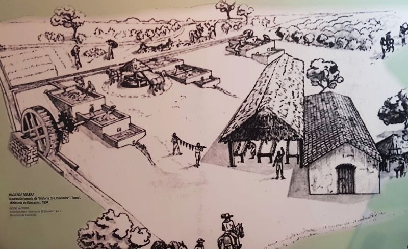
4. An artist's rendering of an indigo hacienda
Ilustración tomada de “Historia de El Salvador”. Tomo I. Ministerio de Educación, 1994.
Indigo Hacienda
Illustration from “Historia de El Salvador, Vol. I, Ministry of Education.
This image was taken from an exhibit at the Dr. David J. Guzmán Archaeological Museum in San Salvador, El Salvador.
Credits. This page was last revised on May 9, 2021. It was originally submitted on February 21, 2016, by J. Makali Bruton of Accra, Ghana. This page has been viewed 485 times since then and 9 times this year. Photos: 1, 2, 3. submitted on February 21, 2016, by J. Makali Bruton of Accra, Ghana. 4. submitted on November 20, 2019, by J. Makali Bruton of Accra, Ghana.


