Alum Rock in San Jose in Santa Clara County, California — The American West (Pacific Coastal)
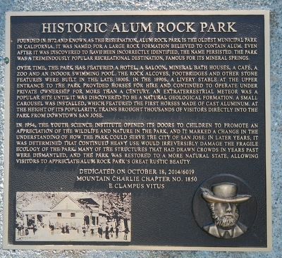
Historic Alum Rock Park
Over time, the park has featured a hotel, a saloon, mineral bath houses, a cafe, a zoo, and an indoor swimming pool. The rock alcoves, footbridges and other stone features were built in the late 1800s. A livery stable at the upper entrance to the park provided horses for hire and continued to operate under private ownership for more than a century. An extraterrestrial meteor was a popular site until it was discovered to be a natural geological formation. A small carousel was installed, which featured tiger first horsed made of cast aluminum. At the height of its popularity, trains brought thousands of visitors directly into the park from downtown San Jose. In 1954, the Youth Science Institute opened its doors to children to promote an appreciation of the wildlife and nature in the park, ant it marked a change in the understanding of how the park could serve the City of San Jose.
In later years, it was determined that continued heavy use would irreversibly damage the fragile ecology of the park. Many to the structures that had drawn crowds in years past were dismantled, and the park was restored to a more natural state, allowing visitors to appreciate Alum Rock Park's great rustic beauty,
Erected 2014 by E Campus Vitus, Mountain Charlie Chapter No.1850.
Topics and series. This historical marker is listed in this topic list: Natural Features. In addition, it is included in the E Clampus Vitus series list.
Location. 37° 23.757′ N, 121° 48.105′ W. Marker is in San Jose, California, in Santa Clara County. It is in Alum Rock. Marker can be reached from Penitencia Creek Road, on the left when traveling east. Touch for map. Marker is at or near this postal address: 15350 Penitencia Creek Road, San Jose CA 95127, United States of America. Touch for directions.
Other nearby markers. At least 8 other markers are within 4 miles of this marker, measured as the crow flies. Welcome to Alum Rock Park (a few steps from this marker); The Natatorium (about 400 feet away, measured in a direct line); Alum Rock Log Cabin (about 800 feet away); Mineral Springs Grotto (approx. ¼ mile away); The Flood of 1911 and Broad Gauge Rails (approx. 0.7 miles away); Steam Dummies & 25 Cents! (approx. 1.3 miles away); Electrification (approx. 1.3 miles away); Cesar E. Chavez (approx. 3.6 miles away). Touch for a list and map of all markers in San Jose.
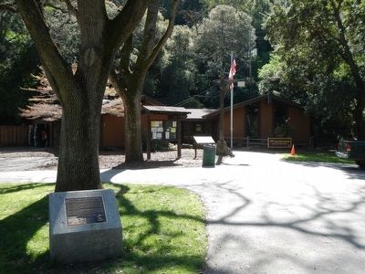
More about this marker. This marker is in front of the Visitors Center and Ranger's Office.
Also see . . . Alum Rock Park History. New Neighborhood Voice - Alum Rock Park History:
The area that would become Alum Rock Park was part of the outermost holdings of the Spanish Pueblo of San Jose de Guadalupe as designated in 1777. During the years when the pueblos provisioned the San Francisco Presidio, the rights to the land were not exercised because such outlying lands were not considered top priority. It was not until California joined the Union in 1850 that the City of San Jose was incorporated and its rights to the pueblo territory were formalized. A provision in the original grant said that if a square tract of land were not possible, then the tract would extend to the summit of the first range of hills. Thus, the City of San Jose’s eastern edge included “The Reservation” as the canyon was called. (Submitted on February 25, 2016, by Barry Swackhamer of Brentwood, California.)
Credits. This page was last revised on February 7, 2023. It was originally submitted on February 25, 2016, by Barry Swackhamer of Brentwood, California. This page has been viewed 672 times since then and 59 times this year. Photos: 1, 2. submitted on February 25, 2016, by Barry Swackhamer of Brentwood, California.

