Ciudad Colonial in Santo Domingo, Distrito Nacional, Dominican Republic — Caribbean Region of the Americas (Hispaniola, Greater Antilles, West Indies)
The Dávila House
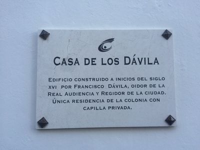
Casa de los Dávila
Edificio construido a inicios del siglo XVI por Francisco Dávila, oidor de la Real Audiencia y regidor de la ciudad. Única residencia de la colonia con capilla privada.
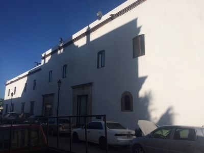
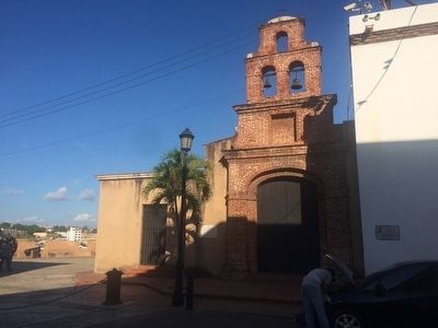
This building was constructed at the beginning of the 16th century for Francisco Dávila, judge in the Royal Court and city councilman. This was the only residence of the colony with a private chapel.
Topics. This historical marker is listed in these topic lists: Colonial Era • Government & Politics.
Location. 18° 28.514′ N, 69° 52.974′ W. Marker is in Ciudad Colonial, Distrito Nacional, in Santo Domingo. Marker is on Calle Las Damas, on the right when traveling north. Touch for map. Marker is in this post office area: Ciudad Colonial, Distrito Nacional 10210, Dominican Republic. Touch for directions.
Other nearby markers. At least 8 other markers are within walking distance of this marker. The Pantheon of the Nation (a few steps from this marker); House of the Jesuits (within shouting distance of this marker); María Toledo Square (within shouting distance of this marker); Chapel of Our Lady of the Remedies (within shouting distance of this marker); a different marker also named Pantheon of the Nation (within shouting distance of this marker); The Residence of Treasurer Cristóbal de Santa Clara (within shouting distance of this marker); Christopher Columbus' Last Residence (about 90 meters away, measured in a direct line); Palace of the Governors (about 90 meters away). Touch for a list and map of all markers in Ciudad Colonial.

Photographed By J. Makali Bruton, January 17, 2016
4. The Dávila House Marker
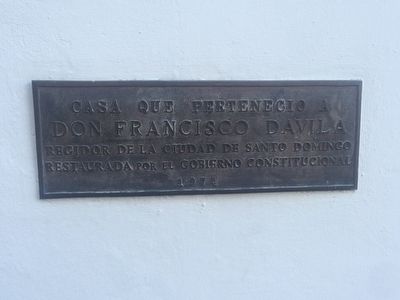
This additional marker on the house reads: Casa que perteneció a Don Francisco Dávila, Regidor de la Ciudad de Santo Domingo, Restaurada por el gobierno constitucional 1974. (English: House that belonged to Francisco Dávila, Councilman of the City of Santo Domingo, Restored by the constitutional government in 1974.)
Credits. This page was last revised on July 28, 2023. It was originally submitted on February 25, 2016, by J. Makali Bruton of Accra, Ghana. This page has been viewed 389 times since then and 21 times this year. Photos: 1, 2, 3, 4. submitted on February 25, 2016, by J. Makali Bruton of Accra, Ghana.


