Pasadena in Anne Arundel County, Maryland — The American Northeast (Mid-Atlantic)
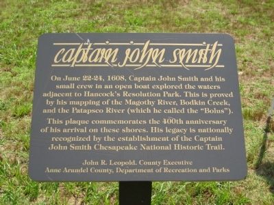
Captain John Smith
This plaque commemorates the 400th anniversary of his arrival on these shores. His legacy is nationally recognized by the establishment of the Captain John Smith Chesapeake National Historic Trail.
John R. Leopold. County Executive. Anne Arundel County, Department of Recreation and Parks.
Erected 2008.
Topics and series. This historical marker is listed in these topic lists: Colonial Era • Exploration • Waterways & Vessels. In addition, it is included in the Captain John Smith Chesapeake National Historic Trail series list. A significant historical month for this entry is June 1680.
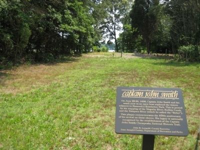
Location. 39° 8.108′ N, 76° 26.854′ W. Marker is in Pasadena, Maryland, in Anne Arundel County. Marker can be reached from Bayside Beach Road, 2.3 miles east of Fort Smallwood Road (Maryland Route 173), on the right when traveling east. Marker is on the grounds of Hancock's Resolution Park, between Bayside Beach Road and the stone house. Touch for map. Marker is in this post office area: Pasadena MD 21122, United States of America. Touch for directions.
Other nearby markers. At least 8 other markers are within 2 miles of this marker, measured as the crow flies. Hancock's Resolution (within shouting distance of this marker); Observing the Enemy (about 300 feet away, measured in a direct line); A Lighthouse Crumbles (approx. 1.7 miles away); The Tonkaway (approx. 1.7 miles away); Kids on the Farm (approx. 1.7 miles away); Improvements on the Bayfront (approx. 1.8 miles away); Veterans of Foreign Wars (approx. 1.8 miles away); Mother's Garden (approx. 1.9 miles away). Touch for a list and map of all markers in Pasadena.
Credits. This page was last revised on November 21, 2019. It was originally submitted on July 18, 2008, by F. Robby of Baltimore, Maryland. This page has been viewed 1,797 times since then and 33 times this year. Photos: 1, 2. submitted on July 18, 2008, by F. Robby of Baltimore, Maryland.

